We all know iconic airports like Lukla, Saba, or Madeira—either because they present a real challenge or because they’re located in stunning environments that make flying there (especially in VR) a truly unforgettable experience.
The goal of this thread is to build a reference list of unique airports, whether for their difficulty or their scenic value, so we always have great destinations at hand when looking for an exciting flight.
Before posting, please check if the airport you want to recommend has already been mentioned to avoid duplicates. Let’s also pay attention to how we write and format our posts, so this thread becomes a useful, well-organized guide for the whole community.
For each recommendation, we suggest including the following information:
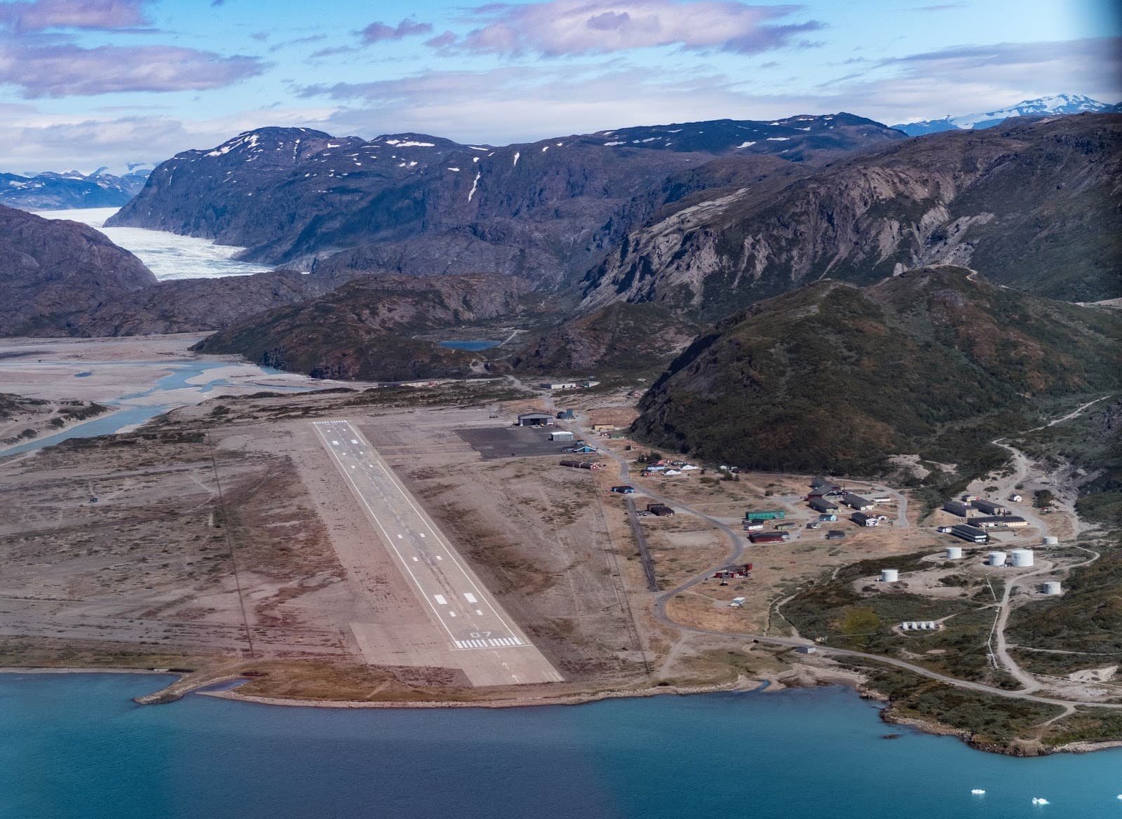
Challenging approaches: Located deep within a narrow fjord and surrounded by steep mountains, pilots must perform sharp descents with limited visibility and often strong crosswinds.
Stunning scenery: Glaciers, icebergs, and dramatic terrain make it a visual highlight—ideal for scenic and adventure flights.
Historic significance: Originally built as a U.S. military base in WWII (Bluie West One), it was a vital stop for transatlantic ferry flights starting in 1942.
Tropic Air Virtual – VNLK Charts Pack (PDF)
Includes charts for approach, altitudes, missed approach routes, and terrain awareness. https://tropicairvirtual.com/Charts/VNLK.pdf
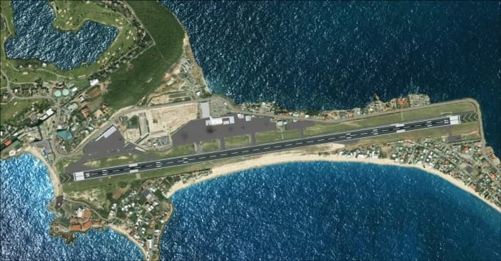
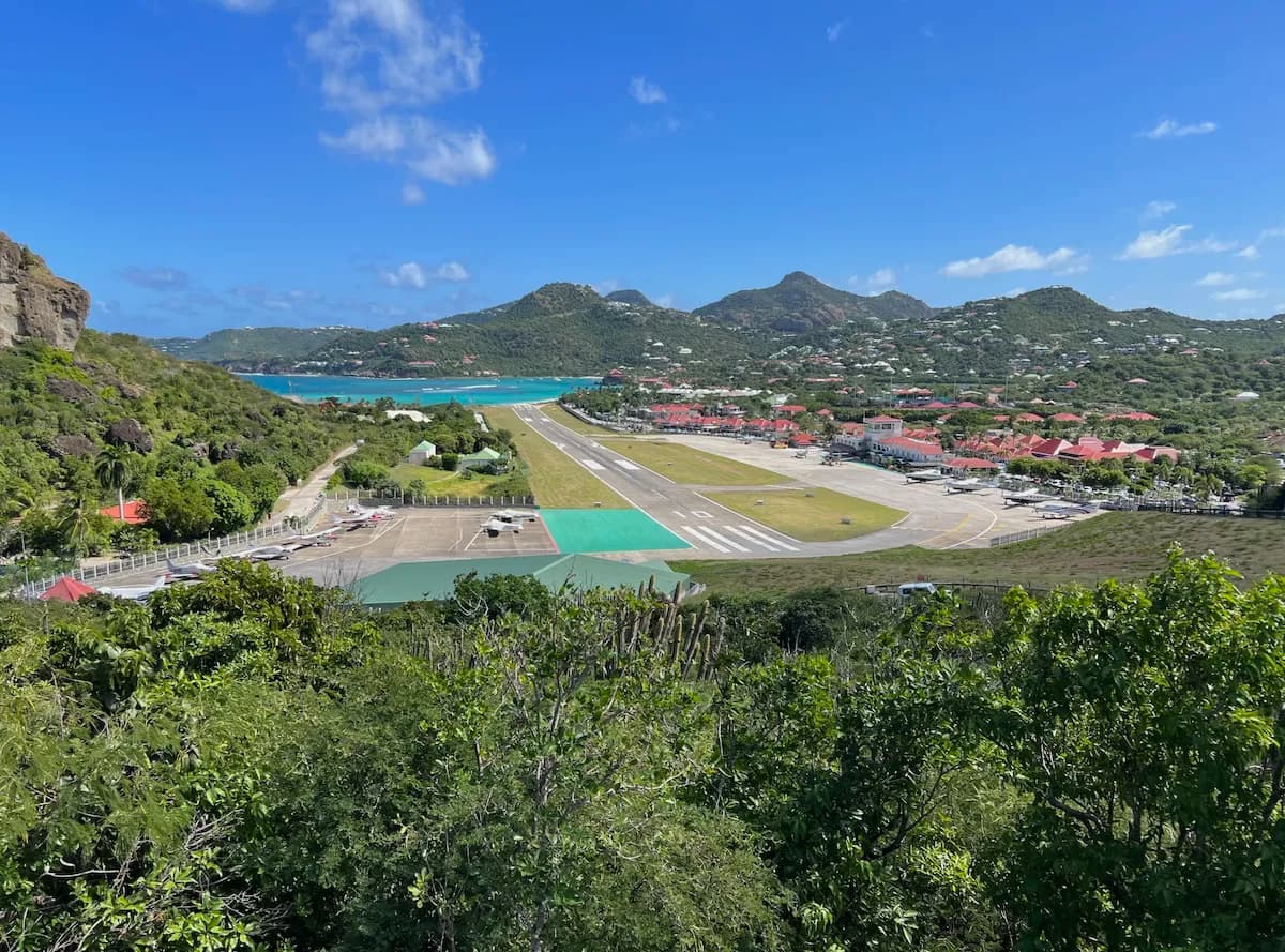
Tourism hotspot: Plane spotting from the beach is legendary, with vacationers flocking to experience the rush of aircraft blasts—though it can be dangerous alamy.com+2en.wikipedia.org+2gettyimages.com+2.
Single-runway Caribbean hub: Compact seaside layout and proximity to Simpson Bay Lagoon make it a visual and operational highlight.
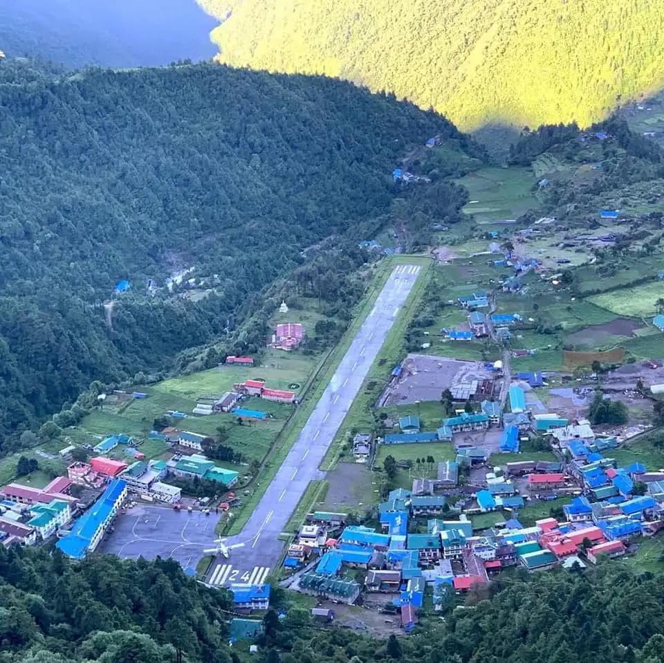
One of the most challenging landings globally: nestled in a deep Himalayan valley, surrounded by peaks up to 5,500 m. Requires steep, low-altitude, visual approaches, navigated manually by specially certified pilots—only eight in the world are qualified. businessinsider.com+2reddit.com+2es.pinterest.com+2
Features: Enhanced valley terrain, custom buildings (monasteries, bridges), waterfall, photoreal vegetation, accurate runway terrain. Available on SimMarket or Orbx secure.simmarket.com+6msfsaddons.com+6fselite.net+6
Ranked among the world’s most dangerous airports—requires pilot certification due to its unique approach constraints. onemileatatime.com+1en.wikipedia.org+1
FlyTampa – St. Barths & Surroundings (available for X‑Plane & P3D)
– High-quality terrain, realistic runway slope
– May include adjacent island coverage (check compatibility)
Asobo Base + Community Mods – Many MSFS users enhance default scenery with free improvements like tree-trimming, static planes, and seaplane port: [Flightsim.to – TFFJ Upgrade & Tree Fix Mod]
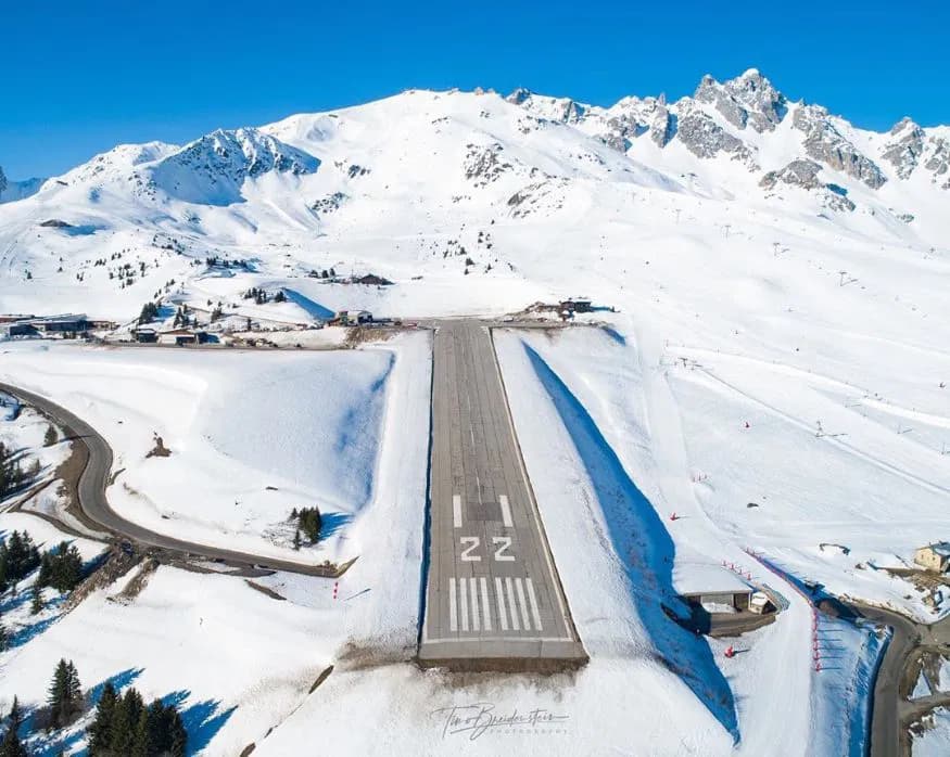
one of the most dangerous airports in the world and in FRANCE this airport is famous for its steep slope and short runway. Courchevel airport ICAO CODE LFLJ this is the video https://www.youtube.com/watch?v=Uw7eBmi1Lt8
Ultra-steep runway (18.6% gradient): Over just 537 m, runway 04/22 slopes uphill—so aircraft land uphill only (go-around impossible), and takeoff must use downhill slope. openaip.net+15en.wikipedia.org+15en.wikipedia.org+15
Missions in MSFS with real challenge scenarios and mission-based cockpit setup for various aircraft types. VASYSTEMS Extreme Challenges – Courchevel msfsmarket.place
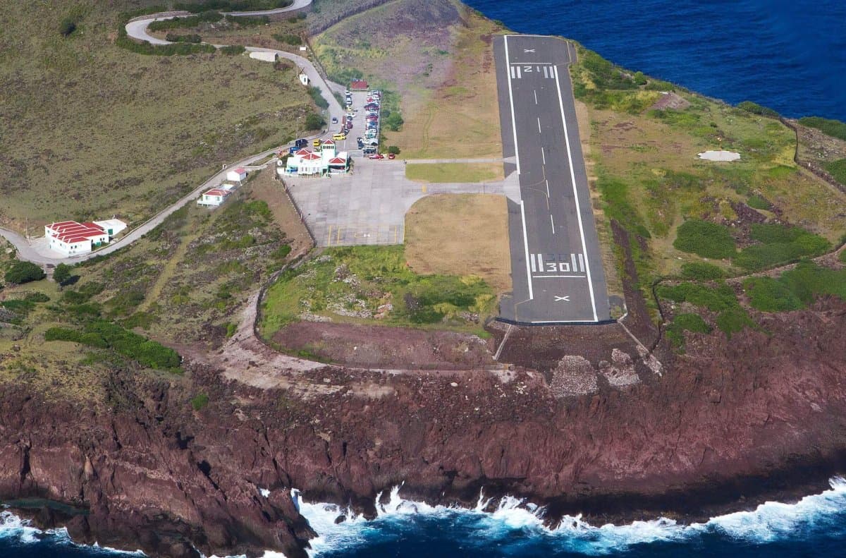
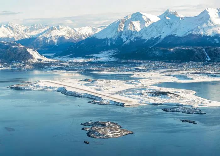
Shortest commercial runway in the world: Just 400 m long, perched between high hills and cliffs dropping straight into the sea—landings and takeoffs are thrilling STOL maneuvers flightsim.to+4en.wikipedia.org+4en.wikipedia.org+4.
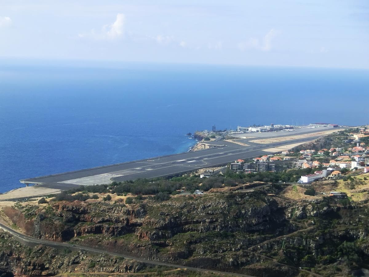
Extremely challenging approaches, due to mountainous terrain, strong crosswinds (often 15–20 kt with gusts to 36 kt), and a dramatic table-top runway that ends over the Atlantic aerosoft.com+1aerosoft.com+1.
The runway extension is perched on 180 concrete pylons, built in 2000 to allow large jets like A340/747; earned the 2004 IABSE Outstanding Structure Award .
Known as Europe’s “Kai Tak”, requiring an ~180° visual turn to final amid complex winds fsnews.eu+1reddit.com+1.
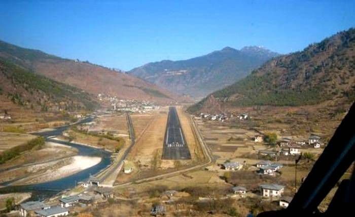
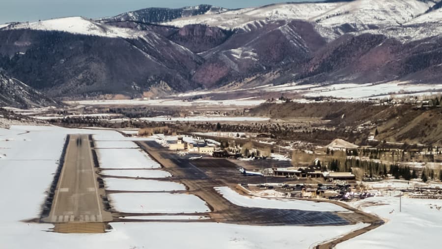
Mountain airport at nearly 8,000 ft elevation, surrounded by steep terrain—demands high-density-altitude performance, steep approaches, and occasional weight/restriction limits for flights msfsaddons.com+2aerosoft.com+2fselite.net+2.
Single-runway, table-top design: Landing south on 15 and departing north on 33; unpredictable alpine winds and a strict nighttime curfew make it operationally demanding simflight.com+13en.wikipedia.org+13sceneryaddons.org+13.
High volume seasonal traffic: Over 600,000 annual passengers in 2024, mostly ski-bound travelers, serviced by regional aircraft like CRJ‑700 and Embraer 175; wing‑span and weight limits enforced airnav.com+13fselite.net+13msfsaddons.com+13.
Navigation Charts & Procedures
Available via Navigraph / Jeppesen and FAA A/FD & Charts:
Just Flight – Aspen XP (X‑Plane 11) (~US$27)
Includes high-res textures, photo scenery of valley, custom mesh runway slope, landmarks and heliport fselite.net+5justflight.com+5justflight.com+5
Airport Name
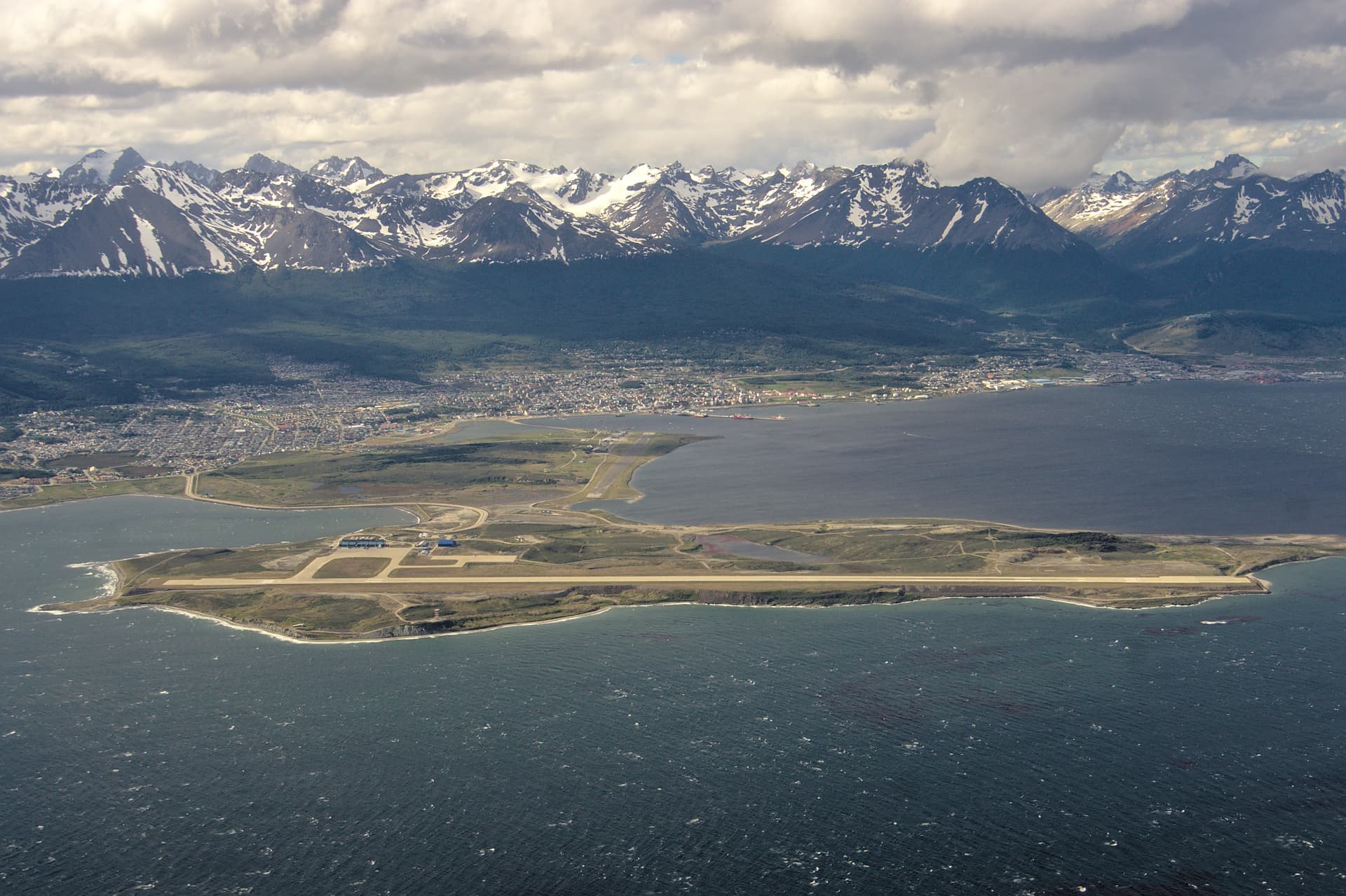
Ushuaia – Malvinas Argentinas International Airport – Argentina
ICAO Code
SAWH (IATA: USH)
Why It’s Interesting World’s southernmost international airport: Located at the tip of South America, Ushuaia is a gateway to Antarctica and Patagonia. Spectacular approach: Nestled between the snow-capped Andes and the Beagle Channel, it features dramatic views and frequently challenging weather conditions including strong winds, turbulence, and rapidly changing visibility. If you have yet to visit Tierra del Fuego, be prepared to fall in love with one of the most beautiful regions on the planet. Unique operations: Supports both regular passenger flights and polar expedition traffic, often involving special cold-weather handling and logistics.
 Airport name (and country)
 ICAO code
 Reason why it’s interesting (challenging approaches, beautiful scenery, etc.)
 Link to navigation charts
 Links to scenery (freeware and payware, for MSFS and X-Plane if possible)
 Link to an image showing the airport and its surrounding location (satellite view or in-sim screenshot)