Airport Name
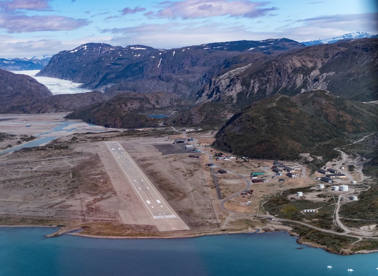
Narsarsuaq Airport – Greenland
 ICAO Code
BGBW (IATA: UAK)
 Why It’s Interesting
- Challenging approaches: Located deep within a narrow fjord and surrounded by steep mountains, pilots must perform sharp descents with limited visibility and often strong crosswinds.
- Stunning scenery: Glaciers, icebergs, and dramatic terrain make it a visual highlight—ideal for scenic and adventure flights.
- Historic significance: Originally built as a U.S. military base in WWII (Bluie West One), it was a vital stop for transatlantic ferry flights starting in 1942.
 Navigation Charts
- Navigraph (Full Procedures, SID/STAR/IAP)
https://charts.navigraph.com/BGBW - Naviair AIM - RNAV (RNP-A) Approach PDF
https://naviair.dk/media/1230/bgbw_rnp-a_approach.pdf - Dauntless Aviation / Simplates (Visual Approach Charts)
https://simplates.com/Narsarsuaq.htm - SkyVector (Airport Info, Radio Navigation)
https://skyvector.com/airport/BGBW/Narsarsuaq-Airport - PilotNav (Procedures and Radio Aids Info)
https://pilotnav.com/airport/BGBW
 Scenery Downloads (MSFS & X-Plane)
- MSFS: “Narsarsuaq X” by FlightSim Greenland
https://es.flightsim.to/file/734/bgbw-narsarsuaq-greenland - X-Plane: Free Greenland sceneries at X-Plane.org
 Image (Airport and Surroundings)