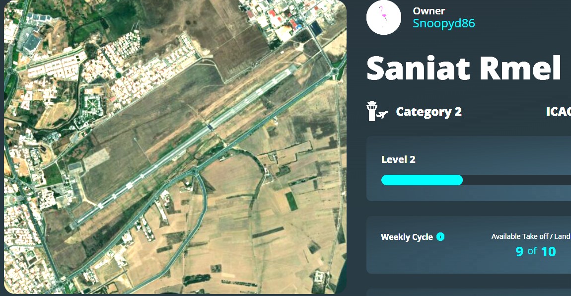
Good Morning,
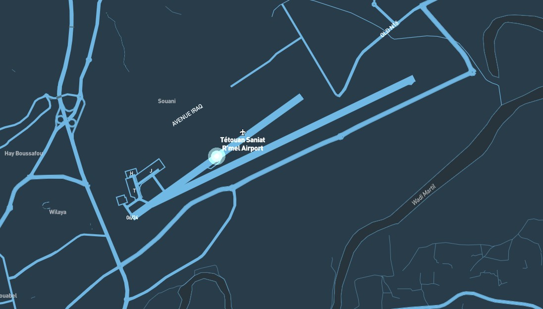
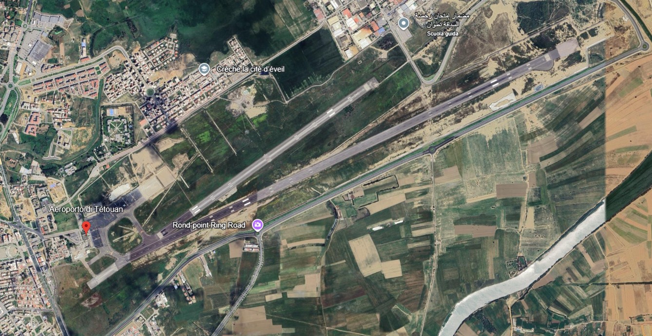
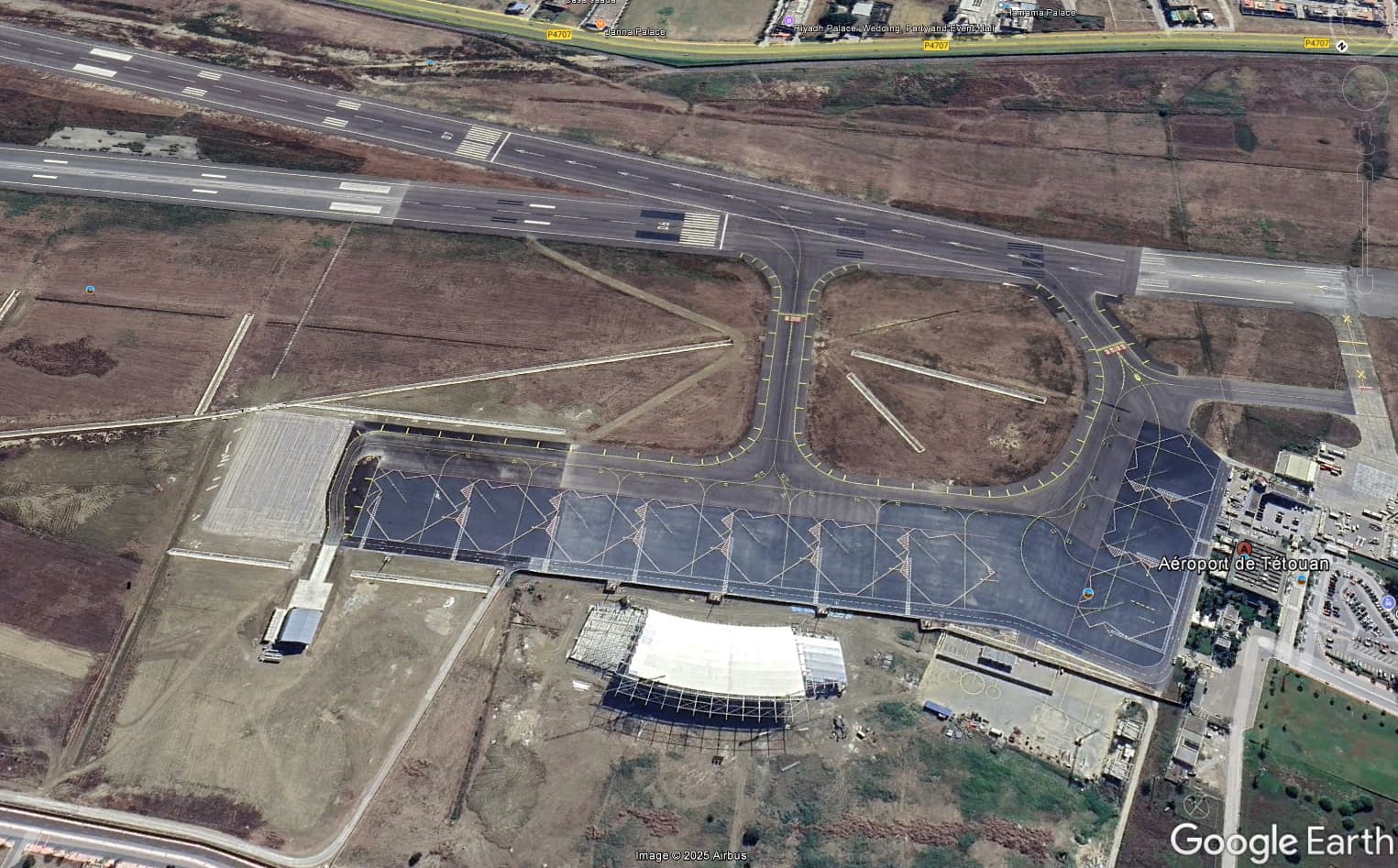
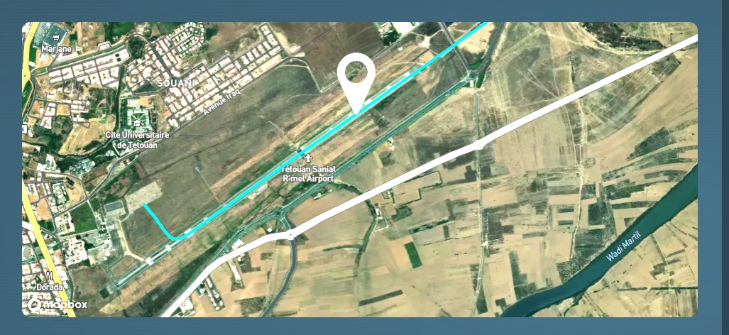
I’m asking you to update the archive images of Tetouan Airport (GMTN). As you can see from the images, If you check the airport has 2 runways and some new taxiways. The SIMFLY image only shows 1 runway and some taxiways, so the flight reports look like you’re landing or taxing on grass but if you check the SIMFLY map the 2 runways are present. Could you please update the airport?
Simfly team can confirm, but I suppose that the satellite images depend from the Mapbox site.
Also the default MSFS2020 scenery has only one runway. If eventual users want the “updated” one they need to download it from https://flightsim.to/file/58289/sania-ramel-airport-morocco-gmtn .
PS is possible the your satellite image describes the “upgrading” of the airport that seems still under construction.
Yes Antonio the new terminal is under construction, but as you said, in the scenery the runways and the taxyways are updated, still in the msfs2024 default the taxyways are updated and the new runway are partially usable and if you check the are the ils charts of the 7/25 runway. In real world the runway 7/25 are the principal runway now.
hopefully if you tried to land on the second runway and for simfly is ok, then it’s only a problem of a satellite picture, otherwise if you have encountered issues on landing or taking off from second runway, then Simfly possibly needs to make a bigger portion of the area, but I don’t think that is the issue, both runways are very close. So I suppose is a Mapbox problem to update the satellite pictures, but I don’t thing this process is done frequently. I also have this problem with SAWB Antarctic base.
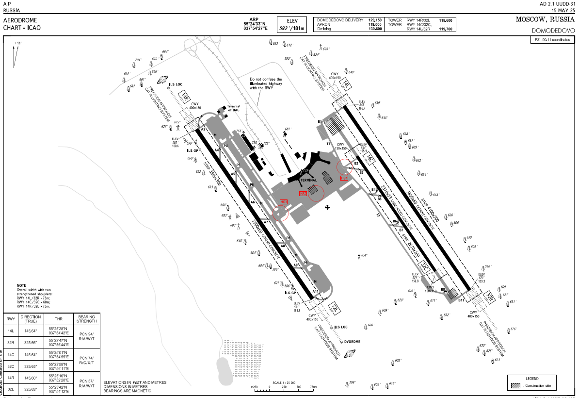
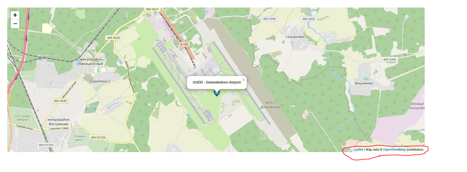
Greetings, friends. I’m experiencing something similar with Domodedovo UUDD. It already has its new terminal and runways ready and operational, and the navigation charts are updated. Only two runways are visible on the Simfly map, but now there are three active runways. All of your navigation charts from May 2025 reflect the three runways and the new terminal, and the ADC also confirms this. Is it possible to update this on the map?
Simfly map is based upon Mapbox company that uses Openstreet as a base map.
Also other sites use Open streetmap as a reference.
Hi, sure! We can update the asset image, but not the Mapbox satellite one — that should be handled on their side. In any case, we’ll check if there are any updates on Mapbox; we’ll work on your asset shortly and I’ll let you know as soon as it’s ready.
Thank you very much ![]()
1 Like
Yes, to report the outdated area by opening a ticket directly with Mapbox Support.
1 Like
Good evening,
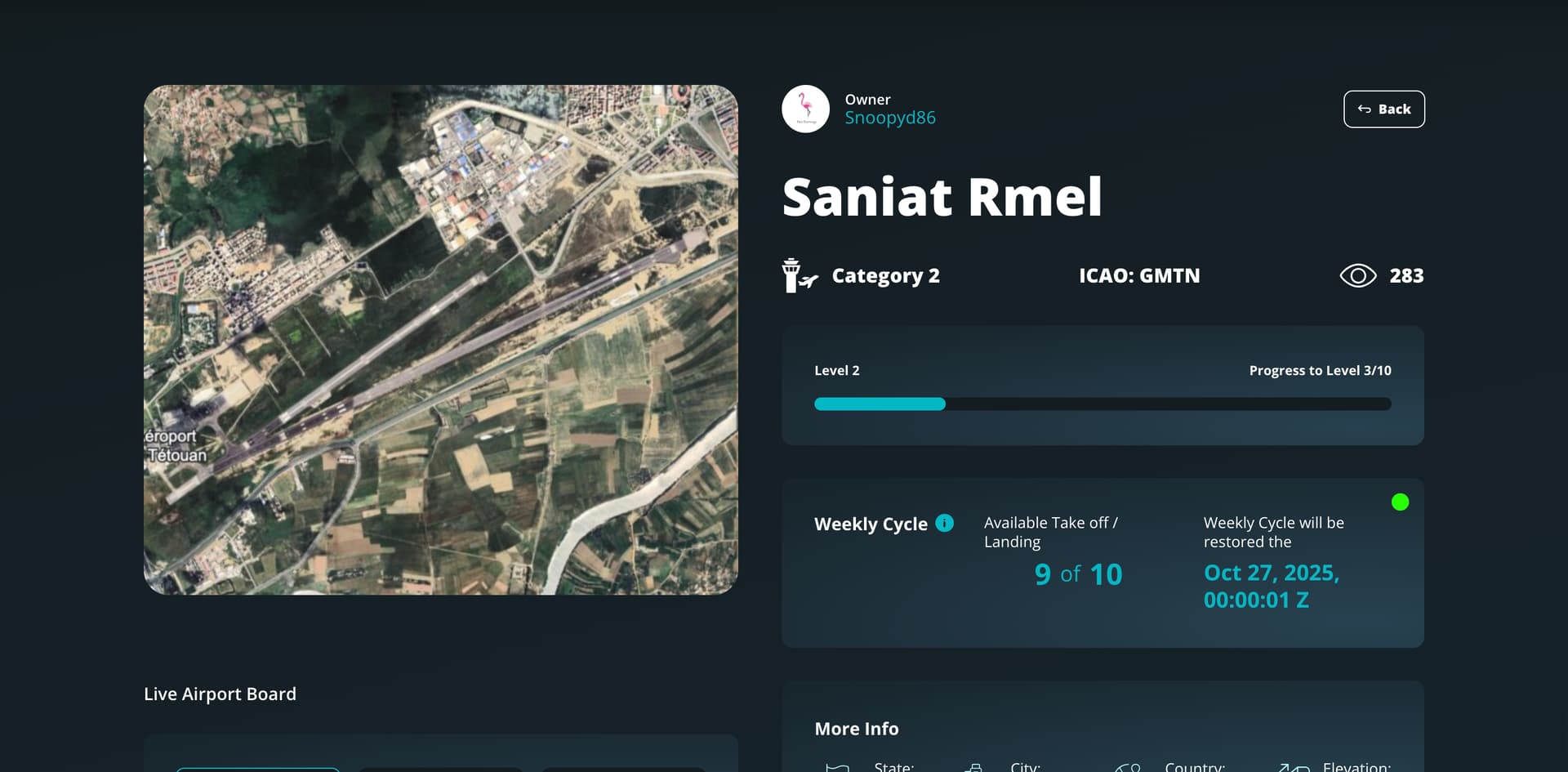
as you can see in the screen, in the report of the flights the image it’s still the old one, can you adjust please?
Hi! Unfortunately, that image comes directly from Mapbox, and at the moment their satellite map for that area hasn’t been updated yet. We can’t modify it ourselves — the update has to be done on their side.
1 Like
This topic was automatically closed after 30 days. New replies are no longer allowed.