Airport Information Board

KMKE - General Mitchell International Airport, Milwaukee, Wisconsin, United States

ICAO: KMKE
SimFly category: 4
Airport level: 2
Pilot payout: 60%
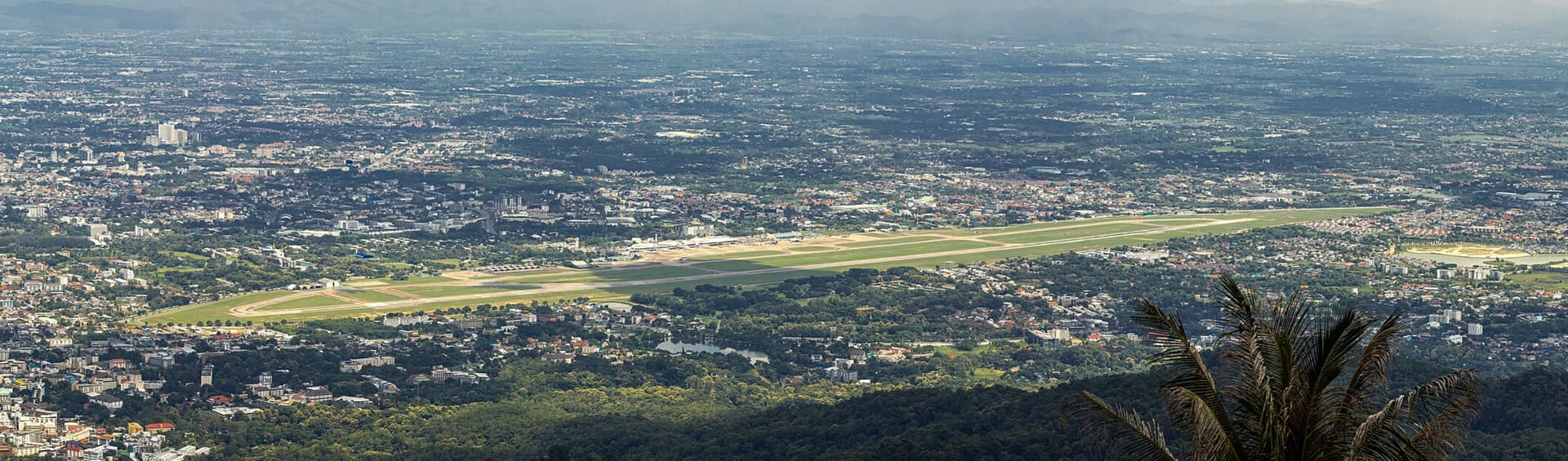
Location: Southeastern Wisconsin, along the western shore of Lake Michigan – Google Maps

Runway(s):
01L/19R – 9,990 ft x 200 ft / 3,045 m x 61 m
07R/25L – 8,300 ft x 150 ft / 2,530 m x 46 m
13/31 – 5,537 ft x 150 ft / 1,688 m x 46 m
07L/25R – 4,797 ft x 100 ft / 1,462 m x 30 m
01R/19L – 4,182 ft x 150 ft / 1,275 m x 46 m

Details: SimFly | KMKE
Flightsim.to: KMKE for Microsoft MSFS
MSFS free payware scenery!!!: iniBuilds Milwaukee (KMKE) for MSFS-2020
XPlane gateway scenery: KMKE Gateway Scenery
SkyVector: KMKE on SkyVector
AirNav: KMKE on AirNav
Other Resources: Official site

Introduction:
Attention MSFS users - iniBuilds offers a FREE payware KMKE addon at the link above.

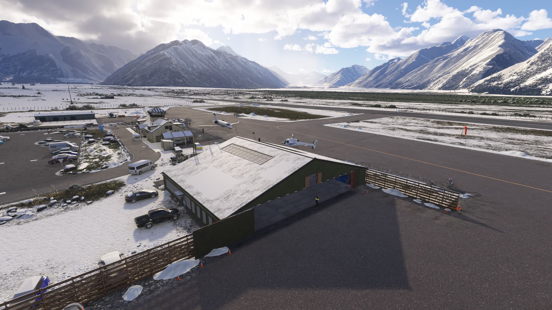
General Mitchell International Airport (KMKE) serves as a vital aviation hub in the Midwest, located just south of downtown Milwaukee, Wisconsin. Named after General Billy Mitchell, a pioneer of U.S. air power, the airport accommodates both civilian and military operations, including the 128th Air Refueling Wing of the Wisconsin Air National Guard. With five runways, including the primary 01L/19R at 9,990 feet, KMKE supports a diverse range of aircraft and operations. The airport’s proximity to Lake Michigan introduces unique weather patterns, offering simulation pilots realistic challenges. Additionally, KMKE’s comprehensive facilities and strategic location make it an excellent alternative to busier hubs like Chicago O’Hare.

2 Likes

NZMC - Mount Cook Airport, Mount Cook Village, New Zealand

ICAO: NZMC
SimFly category: 2
Pilot payout: 60%
Location: Southern Alps, South Island, New Zealand – View on Google Maps
Runway: 13/31, 4,833 ft x 98 ft / 1,473 m x 30 m
Airport Elevation: 2153 ft / 656 m

Details: SimFly | NZMC
Flightsim.to: N/A
MSFS payware scenery: NZA Simulations – NZMC Mount Cook Region
XPlane gateway scenery: X-Plane Scenery Gateway - NZMC
SkyVector: SkyVector – NZMC

Introduction:
Looking for stunning? Look no further.

Located 10nm south of Aoraki/Mount Cook, New Zealand’s tallest mountain at 12,218 ft / 3724 m, Mount Cook Airport (NZMC) is nestled in the breathtaking Southern Alps of New Zealand, serving as a gateway to Aoraki/Mount Cook National Park. Though commercial airline service is rare today, the airport remains a vital hub for scenic flights, glacier landings, and alpine tourism. Its single 4833 ft asphalt runway is surrounded by dramatic mountain terrain, making it a favorite among bush pilots and VFR enthusiasts.

The airport is especially popular in flight simulators for its challenging approaches, stunning visuals, and proximity to the Tasman Glacier. NZA Simulations’ payware scenery for MSFS adds immersive detail, including a fully modeled terminal and nearby Glentanner Aerodrome (NZGT), enhancing the realism of this iconic alpine destination.

Images below from MSFS 2024 with the payware NZA Simulations – NZMC Mount Cook Region


3 Likes

KHVN - Tweed-New Haven Airport, New Haven, Connecticut, United States

ICAO: KHVN
SimFly category: 3
Pilot payout: 60%
Location: Southern Connecticut shoreline - Google Maps
Runway: 02/20, 5600 ft X 150 ft / 1707 m X 46 m

Details: SimFly | KHVN
Flightsim.to: KHVN - Tweed New Haven Airport for MSFS
MSFS payware scenery: Orbx - KHVN Tweed New Haven Airport
XPlane gateway scenery: X-Plane Scenery Gateway - KHVN
SkyVector: SkyVector - KHVN
AirNav: AirNav Data for KHVN
Other Resources: Official site

Introduction:
Tweed-New Haven Airport (KHVN) is a regional airport located along the southern Connecticut coastline, serving the historic city of New Haven — home to Yale University. KHVN is known for its unique location between the Long Island Sound and residential neighborhoods, which adds complexity to visual and instrument approaches, especially in challenging weather conditions. The airport recently saw renewed commercial service with Avelo Airlines, increasing its profile in the aviation community. Its single runway supports regional jets and general aviation, and its scenic approaches over the water and compact airfield layout make it a favorite for simulation pilots looking for short-haul realism and a bit of coastal flying charm.

2 Likes

KJAC - Jackson Hole Airport, Jackson, Wyoming, United States

ICAO: KJAC
SimFly category: 4
Pilot payout: 60%
Location: Grand Teton National Park, Northwest Wyoming - Google Maps
Runway: 01/19, 6,300 ft x 150 ft / 1,920 m x 46 m
Elevation: 6,451 ft / 1993 m

Details: SimFly | KJAC
Flightsim.to: Odogs Jackson Hole - KJAC for MSFS
MSFS payware scenery: Jackson Hole Airport MSFS by Dreamflight | Contrail Shop
XPlane gateway scenery: X-Plane Scenery Gateway - KJAC
SkyVector: SkyVector KJAC Information
AirNav: AirNav KJAC Information
Other Resources: Official site

Introduction:
Jackson Hole Airport (KJAC) is uniquely positioned inside Grand Teton National Park, making it the only commercial airport located within a U.S. national park. Surrounded by the towering Teton Range, the airport is often ranked as one of the most stunningly beautiful airports in the United States.

KJAC’s single runway supports both commercial and general aviation operations, including seasonal airline traffic and private jet activity. Approaches into KJAC can be challenging due to high terrain and unpredictable mountain weather, making it a favorite among simulation pilots looking for scenic yet demanding procedures. The airport’s elevation and stunning visuals—especially during sunrise or snowy months—make it an unforgettable destination in any simulator.

3 Likes

ICAO: KBUF - Buffalo Niagara International Airport
SimFly category: 4
Pilot payout: 60%
Location: is located 4 mi (6.4 km) east of downtown Niagara Falls, in the Town of Niagara in Niagara County, New York, United States.
Runway: 23/05 8,835 ft x 150 ft and runway 14/32 7,155 ft x 150 ft
Elevation: 704 ft / 233 m

Flightsim.to: https://flightsim.to/file/29323/kbuf-buffalo-niagara-international-airport
SkyVector: BUF - Buffalo Niagara International Airport | SkyVector
XPlane gateway scenery: X-Plane Scenery Gateway
AirNav: AirNav: KBUF - Buffalo Niagara International Airport
Other Resources:

Buffalo Niagara International Airport opened as Buffalo Municipal Airport in 1926 on former farmland, making it one of the country’s oldest public airports … Buffalo Niagara International Airport - Wikipedia

2 Likes

ICAO: CYZX - Greenwood
SimFly category: 3
Pilot payout: 60%
Location; is a Canadian Forces Base located 1.5 nautical miles east of Greenwood, Nova Scotia.
Runway: 26/08 7,984 ft x 193 ft ( ILS 26 ) and runway 30/12 7,972 ft x 183 ft
Elevation: 83 ft / 25 m

Flightsim.to: https://flightsim.to/file/81478/cyzx-cfb-greenwood-airport-ns
SkyVector: CYZX - Greenwood Airport | SkyVector
XPlane gateway scenery: X-Plane Scenery Gateway

Greenwood, is a Canadian Forces Base located 1.5 nautical miles (2.8 km; 1.7 mi) east of Greenwood, Nova Scotia. It is primarily operated as an air force base by the Royal Canadian Air Force and is one of two bases in the country using the CP-140 Aurora and CP-140A Arcturus anti-submarine/maritime patrol and surveillance aircraft, the other being CFB Comox. Its primary RCAF lodger unit is 14 Wing, commonly referred to as 14 Wing Greenwood.

2 Likes

ICAO: KDPA - DuPage Airport
SimFly category: 3
Pilot payout: 60%
Location; is a general aviation airport located 29 miles (47 km) west of downtown Chicago in West Chicago, DuPage County, Illinois, United States.
Runway: 4 runways : runway 02 L/20 R 7,558 ft x 148 ft ( ILS 02 L ), runway 10 / 28 4,741 x 68 ft ( ILS 10 ), runway 02 R/20 L 6,433 ft x 97 ft, runway 33 / 15 3,397 ft x 100 ft.
Elevation: 755 ft / 250 m

Flightsim.to: https://flightsim.to/product/kdpa-dupage-airport
SkyVector: DPA - Dupage Airport | SkyVector
XPlane gateway scenery: X-Plane Scenery Gateway
AirNav: AirNav: KDPA - DuPage Airport
Official site : https://www.dupageairport.gov/

DuPage Airport is located on what used to be sheep-grazing land. In 1927, two Chicago entrepreneurs purchased the land and began barnstorming, using the field as a grass strip. In 1941 … DuPage Airport - Wikipedia

2 Likes

LSZC - Buochs Airport, Nidwalden, Switzerland

ICAO: LSZC
SimFly category: 3
Pilot payout: 60%
Location: Central Switzerland, south of Lake Lucerne – View on Google Maps

Runway: 07/25, 6558 ft x 131 ft / 1999 m x 40 m
Elevation: 1476 ft / 450 m

Details: SimFly | LSZC
Flightsim.to: Buochs Air Base - LSZC for MSFS
MSFS payware scenery: simMarket: BUOCHS LSZC MSFS2020
XPlane gateway scenery: View LSZC on the X-Plane Scenery Gateway
SkyVector: LSZC Airport Info on SkyVector
AirNav: LSZC Info on AirportNavFinder
Other Resources: Official site | About us - Buochs ​​Airport
Other Resources: FlyLogicSoftware - Buochs Airport | MSFS [Official Trailer]

Introduction:
Buochs Airport (pronounced “boo-ox”) (LSZC) is a gem nestled in the dramatic Swiss Alps, offering one of the most breathtaking general aviation settings in Europe. Located near the town of Stans and just south of the shimmering Lake Lucerne, this airfield is surrounded by towering alpine peaks and lush valleys, making for stunning yet challenging approaches.

LSZC is famously the home of Pilatus Aircraft Ltd., the Swiss manufacturer known for the PC-12 and PC-24, and the airport regularly sees test flights and deliveries. While LSZC does not support scheduled commercial flights, it is a favorite among private pilots, glider operators, and aviation enthusiasts drawn to both its technical interest and scenic charm. This airport is also a key location for VFR training, and its positioning near mountainous terrain demands excellent situational awareness, especially during arrival and departure.

1 Like

ICAO: KGPI - Glacier Park International Airport
SimFly category: 3
Pilot payout: 60%
Location; is in Flathead County, Montana, United States, six miles northeast of Kalispell.
Runway: runway 02 /20 8,992 ft x 138 ft ( ILS 02 ), runway 30 / 12 3,499 x 72 ft.
Elevation: 2,971 ft / 990 m

Flightsim.to: https://flightsim.to/discover/KGPI
SkyVector: GPI - Glacier Park International Airport | SkyVector
XPlane gateway scenery: https: X-Plane Scenery Gateway
AirNav: AirNav: KGPI - Glacier Park International Airport
Official site : https://iflyglacier.com/

The airport was built in 1942 as Flathead County Airport, from which its IATA and original FAA and ICAO codes were derived. Airline flights operated by Northwest Airlines began in 1950; however, passenger traffic was sparse for years. In 1970 the airport was designated as an international airport and received its current name … Glacier Park International Airport - Wikipedia

1 Like

ICAO: KGTF - Great Falls International Airport
SimFly category: 3
Pilot payout: 60%
Location; is a public/military airport in city limits three miles southwest of central Great Falls in Cascade County, Montana, United States.
Runway: 21 / 03 10,503 ft x 150 ft ( ILS 03 ), runway 35 / 17 6026 x 150 ft.
Elevation: 3,662 ft / 1,116 m

SkyVector:GTF - Great Falls International Airport | SkyVector
XPlane gateway scenery: X-Plane Scenery Gateway
AirNav: AirNav: KGTF - Great Falls International Airport
Official site : https://flygtf.com/

Great Falls International Airport is home to Great Falls Air National Guard Base, which hosts the Montana Air National Guard’s 120th Airlift Wing (120 AW), the “Vigilantes.” Operationally-gained by Air Mobility Command (AMC), the 120 AW reequipped with the Lockheed C-130 Hercules in 2014, which it employs in medium airlift missions. In its previous incarnation as the 120th Fighter Wing, it previously flew the McDonnell Douglas F-15 Eagle … Great Falls International Airport - Wikipedia

1 Like

ICAO: KLMT Crater Lake - Klamath Regional Airport (Klamath Falls Airport).
SimFly category: 3
Pilot payout: 60%
Location; The airport is five miles southeast of Klamath Falls.
Runway: 32 / 14 10292 ft x 140 ft ( ILS 32 ), runway 07 / 25 5244 x 85 ft.
Elevation: 4,091 ft / 1,373 m

Flightsim.to: https://flightsim.to/file/48026/klamath-falls-klmt-usa
SkyVector: LMT - Crater Lake/Klamath Regional Airport | SkyVector
XPlane gateway scenery: X-Plane Scenery Gateway
AirNav: https: AirNav: KLMT - Crater Lake/Klamath Regional Airport

In 1928, the citizens of Klamath Falls approved the sale of $50,000 worth of bonds to build Klamath Falls Municipal Airport. It had gravel runways and one Fixed-Base Operator; in 1942, it was selected for a … Crater Lake–Klamath Regional Airport - Wikipedia

1 Like

VTCC - Chiang Mai International Airport, Chiang Mai, Thailand

ICAO: VTCC
IATA: CNX
SimFly Category: 4
Pilot Payout: 50-60%
Location: Northern Thailand – View on Google Maps
Runway(s):
RW18 Length (m/ft) 3,400 / 11,155 X 45 m
RW36 Length (m/ft) 3,400 / 11,155 X 45 m
Elevation: 1,036 ft / 316 m
Surface: Concrete / Asphalt

Flightsim.to: Freeware Chiang Mai VTCC Scenery (MSFS)
Flightsim.to: Payware Chiang Mai VTCC Airport
MSFS payware scenery: BDO Aviation - VTCC at SimMarket
XPlane gateway scenery: VTCC on X-Plane Scenery Gateway
SkyVector: Chiang Mai VTCC Airport Chart and Info
AirNav: VTCC Airport Information (AirNav)
Other Resources: OurAirports - VTCC Info

Introduction:
Chiang Mai International Airport (VTCC) is a major gateway to Northern Thailand and one of the busiest regional airports in the country, serving both domestic and international routes. Nestled near the foothills of the Himalayas, VTCC is renowned among sim pilots for its scenic surroundings and terrain-based approach challenges. The airport features a single runway with full ILS capability for runway 36, commonly used for arrivals due to prevailing winds. VTCC is used by a mix of commercial jets, regional turboprops, and occasional military and charter operations. The parallel taxiway and open apron provide ample room for ground handling simulation. Chiang Mai’s cultural significance and natural beauty make it a favorite destination for virtual flyers who want to explore the historic and mountainous north of Thailand.

3 Likes

KMRY – Monterey Regional Airport, Monterey, California, USA

ICAO: KMRY
IATA: MRY
FAA LID: MRY
SimFly Category: 3
Pilot Payout: 60%
Location: Monterey, California – View on Google Maps
Runways:
10R/28L – 7,616 ft × 150 ft (2,321 m × 46 m), Asphalt
10L/28R – 3,513 ft × 60 ft (1,071 m × 18 m), Asphalt
Elevation: 257 ft (78 m) MSL

Introduction

Monterey Regional Airport (KMRY) serves as the primary gateway to California’s central coast, offering both domestic and international flights. Located approximately 3 miles southeast of downtown Monterey, the airport spans 597 acres and is managed by the Monterey Peninsula Airport District. In 2024, it handled over 622,000 passengers and 57,000 aircraft operations, reflecting its significance in regional and national air travel.montereyairport.specialdistrict.org+5airports-worldwide.com+5centreforaviation.com+5

The airport features two parallel runways (10R/28L and 10L/28R), both constructed with asphalt and measuring over 7,600 feet in length. Runway 10R/28L underwent a major renovation in 2019, replacing its asphalt surface with concrete to enhance durability and performance. Operational flow is typically southbound, utilizing runways 10R and 10L, but can switch to northbound operations on runways 28R and 28L during certain wind conditions.skybrary.aero+3airports-worldwide.com+3bigorre.org+3

KMRY is also a hub for general aviation and cargo operations, with nearby facilities like Monterey Peninsula Airport District and Monterey Peninsula Airport District supporting these activities. The airport’s modernization efforts, including the expansion of Terminal B and the introduction of an Automated People Mover system, have improved passenger experience and operational efficiency.bigorre.org+1en.wikipedia.org+1

2 Likes

KNEW – Lakefront Airport, New Orleans, Louisiana, USA

ICAO: KNEW
IATA: NEW
FAA LID: NEW
SimFly Category: 3
Pilot Payout: 60%
Location: New Orleans, Louisiana – View on Google Maps
Runways:
9/27 – 3,114 ft × 75 ft (949 m × 23 m), Asphalt
18L/36R – 3,697 ft × 75 ft (1,127 m × 23 m), Asphalt
18R/36L – 6,880 ft × 150 ft (2,097 m × 46 m), Asphalt
Elevation: 7 ft (2 m) MSL

Flightsim.to: Freeware KNEW for MSFS
MSFS Payware Scenery: [Developer name and product link, if available]
X-Plane Gateway Scenery: KNEW Lakefront Airport
SkyVector: KNEW on SkyVector
AirNav: KNEW on AirNav

Introduction

Lakefront Airport (KNEW) is a public-use general aviation airport located approximately 5 miles northeast of downtown New Orleans, Louisiana. Once the primary commercial airport for the city until 1946, it now serves as a hub for private, charter, and occasional military flights. The airport is situated on the shores of Lake Pontchartrain, offering scenic approaches and departures. It features three asphalt runways, with the longest being 18R/36L at 6,880 feet. The airport is managed by the Lakefront Management Authority and is open 24 hours, with a control tower operating from 0700 to 2100 local time. flyingmag.com+7airnav.com+7en.wikipedia.org+7en.wikipedia.org+1acukwik.com+1

3 Likes

MWCB – Charles Kirkconnell International Airport, Cayman Brac, Cayman Islands

ICAO: MWCB
IATA: CYB
SimFly Category: 3
Pilot Payout: 60%
Location: Cayman Brac, Cayman Islands – View on Google Maps
Runway(s):
09/27 – 6,001 ft × 148 ft (1,829 m × 45 m), Asphalt
Elevation: 8 ft (2 m) MSL

Flightsim.to: Freeware MWCB for MSFS
MSFS Payware Scenery: [Developer name and product link, if available]
X-Plane Gateway Scenery: MWCB Cayman Brac Airport
SkyVector: MWCB on SkyVector
AirNav: MWCB on AirNav

Introduction

Charles Kirkconnell International Airport (MWCB), formerly known as Gerrard-Smith International Airport, serves as the primary gateway to Cayman Brac, one of the three islands of the Cayman Islands archipelago. Located approximately 6 km southwest of Stake Bay, the airport is situated on the southwestern end of Cayman Brac, with its runway paralleling the south shoreline. Approaches and departures are conducted over the water, offering scenic views of the Caribbean Sea. skyvector.com+11en.wikipedia.org+11thresholdx.net+11

The airport features a single asphalt runway (09/27), measuring 6,001 feet in length and 148 feet in width, accommodating regional flights primarily operated by Cayman Airways. These flights connect Cayman Brac to Owen Roberts International Airport on Grand Cayman and Edward Bodden Airfield on Little Cayman. The airport is open to the public and operates as an international airport of entry, with customs and immigration services available. metar-taf.com+4flightera.net+4thresholdx.net+4

Pilots should be aware of the airport’s operating hours, which are from 1200 to 0000 UTC, and the high-intensity runway lighting system in place. Additionally, the airport is equipped with a non-directional beacon (CBC) located 1 nautical mile off the approach threshold of Runway 27, aiding in navigation. acukwik.com+2airport-data.com+2acukwik.com+2en.wikipedia.org

2 Likes

KFFO – Wright-Patterson Air Force Base, Dayton, Ohio, USA

ICAO: KFFO
IATA: FFO
FAA LID: FFO
SimFly Category: 2
Pilot Payout: 60%
Location: Dayton, Ohio – View on Google Maps
Runways:
05L/23R – 12,598 ft × 299 ft (3,843 m × 91 m), PEM
05R/23L – 7,001 ft × 151 ft (2,134 m × 46 m), Asphalt
Elevation: 823 ft (251 m) MSL

Flightsim.to: Freeware KFFO for MSFS
MSFS Payware Scenery: [Developer name and product link, if available]
X-Plane Gateway Scenery: KFFO Wright-Patterson AFB
SkyVector: KFFO on SkyVector
AirNav: KFFO on AirNav

Introduction

Wright-Patterson Air Force Base (KFFO) is a significant U.S. Air Force installation located in Dayton, Ohio. Established in 1943, it serves as a hub for research, development, and logistics operations. The base is home to the Air Force Materiel Command and the Air Force Research Laboratory, among other key organizations. Its rich aviation history includes being the site where the Wright brothers conducted early flight experiments.fltplan.com+3maps.avnwx.com+3airnav.com+3flightsim.to

The airport features two runways: 05L/23R, the primary runway at 12,598 feet, and 05R/23L at 7,001 feet. Runway 05L/23R is equipped with a Precision Approach Category II (PEM) system, accommodating various military and civilian aircraft. The base operates under Class D airspace with a 24-hour control tower, and pilots are required to obtain prior permission for operations.airnav.com+4metar-taf.com+4acukwik.com+4fltplan.com

For flight simulation enthusiasts, KFFO offers a detailed and historically rich environment. The MSFS freeware scenery package includes accurate representations of the runways, taxiways, and notable structures such as the National Museum of the United States Air Force. This package provides an immersive experience for both virtual pilots and aviation history aficionados.flightsim.to

2 Likes

KLFI – Langley Air Force Base, Hampton, Virginia, USA

ICAO: KLFI
IATA: LFI
FAA LID: LFI
SimFly Category: 2
Pilot Payout: 60%
Location: Hampton, Virginia – View on Google Maps
Runway(s):
08/26 – 10,002 ft × 150 ft (3,048 m × 46 m), Concrete
Elevation: 8 ft (2.4 m) MSL

Flightsim.to: Freeware KLFI for MSFS
MSFS Payware Scenery: [Developer name and product link, if available]
X-Plane Gateway Scenery: KLFI Langley AFB
SkyVector: KLFI on SkyVector
AirNav: KLFI on AirNav

Introduction

Langley Air Force Base (KLFI) is a historic U.S. Air Force base located in Hampton, Virginia. Established in 1917, it was one of the first military airfields in the United States. In 2010, Langley AFB merged with Fort Eustis to form Joint Base Langley–Eustis, a combined military installation serving both the U.S. Air Force and Army. airports-worldwide.com+7en.wikipedia.org+7airnav.com+7airforce-technology.com+2en.wikipedia.org+2en.wikipedia.org+2

The base features a single runway, 08/26, which is 10,002 feet long and 150 feet wide, constructed of concrete. It serves as a hub for various military operations, including the Air Combat Command and the 1st Fighter Wing. en.wikipedia.org

For flight simulation enthusiasts, KLFI offers a detailed and historically rich environment. The MSFS freeware scenery package includes accurate representations of the runway, taxiways, and notable structures such as the National Air and Space Museum’s Steven F. Udvar-Hazy Center. This package provides an immersive experience for both virtual pilots and aviation history aficionados.

2 Likes

KHST – Homestead Air Reserve Base, Homestead, Florida, USA

ICAO: KHST
IATA: HST
FAA LID: HST
SimFly Category: 2
Pilot Payout: 60%
Location: Homestead, Florida – View on Google Maps
Runway(s):
06/24 – 11,202 ft × 300 ft (3,414 m × 91 m), Concrete
Elevation: 6 ft (1.8 m) MSL

Flightsim.to: Freeware KHST for MSFS
MSFS Payware Scenery: [Developer name and product link, if available]
X-Plane Gateway Scenery: KHST Homestead Air Reserve Base
SkyVector: KHST on SkyVector
AirNav: KHST on AirNav

Introduction

Homestead Air Reserve Base (KHST) is a U.S. Air Force Reserve installation located approximately 6 miles northeast of Homestead, Florida, near the southern tip of the Florida peninsula, about 25 miles south of Miami. Established in 1942 as Homestead Army Airfield, the base was severely damaged by Hurricane Andrew in 1992 and was subsequently rebuilt, reopening as an Air Force Reserve facility in 1994. homestead.afrc.af.mil+4militarybases.us+4off-basehousing.com+4

The base is home to the 482nd Fighter Wing, which operates F-16C/D Fighting Falcon aircraft. The wing is a fully combat-ready unit capable of providing mission-ready pilots and support personnel for short-notice worldwide deployment. Additionally, the base hosts several tenant units, including Headquarters Special Operations Command South, the U.S. Coast Guard Maritime Safety and Security Team, and an air and maritime unit of U.S. Customs and Border Protection.

KHST features a single runway, 06/24, which is 11,202 feet long and 300 feet wide, constructed of concrete. The runway is equipped with a high-intensity approach lighting system and precision instrument markings, supporting various military and civilian operations. pilotnav.com

For flight simulation enthusiasts, KHST offers a detailed and historically rich environment. The MSFS freeware scenery package includes accurate representations of the runway, taxiways, and notable structures such as the 482nd Fighter Wing facilities. This package provides an immersive experience for both virtual pilots and aviation history aficionados.militarybases.us+2en.wikipedia.org+2en.wikipedia.org+2

2 Likes

ICAO: CYRV - Revelstoke
SimFly category: 2
Pilot payout: 60%
Location ; is located 1.7 nautical miles south southeast of Revelstoke, British Columbia, Canada.
Runway: 30 / 12 5125 ft x 85 ft.
Elevation: 1455 ft / 485 m
Flightsim.to: https://flightsim.to/discover/CYRV
SkyVector: CYRV - Revelstoke Airport | SkyVector
XPlane gateway scenery: X-Plane Scenery Gateway

Discover the beauty and challenges of Revelstoke Airport (CYRV). Brace yourself for a thrilling challenge as you navigate through the narrow valleys and unpredictable weather conditions surrounding the airport. The approach to Revelstoke Airport demands precision and skill, making it a favourite destination for seasoned pilots looking to put their abilities to the test.

2 Likes

ICAO: KOSC Oscoda Wurtsmith Airport.
SimFly category: 2
Pilot payout: 60%
Location ; is a public use airport located 3 nautical miles (6 km) northwest of the central business district of Oscoda, an unincorporated community in Iosco County, Michigan, United States.
Runway: 25 / 07 ( ILS 25 ) 11792 ft x 197 ft.
Elevation: 626 ft / 208 m
SkyVector: OSC - Oscoda/Wurtsmith Airport | SkyVector
XPlane gateway scenery: X-Plane Scenery Gateway

Oscoda–Wurtsmith Airport became a public airport in 1993. It is primarily a large jet airplane salvage … Oscoda–Wurtsmith Airport - Wikipedia

1 Like