Airport Information Board

Welcome to the Airport Information Board!

This thread is for sharing detailed posts about user-owned, activated SimFly airports—whether major hubs or small regional fields, feel free to post about it here! To add to this thread, scroll to the last post at the bottom and use the blue “Reply” button.

:small_blue_diamond: Please Note: This topic is intended strictly for airport information posts. Please avoid general commentary, questions, or unrelated conversations in this thread.

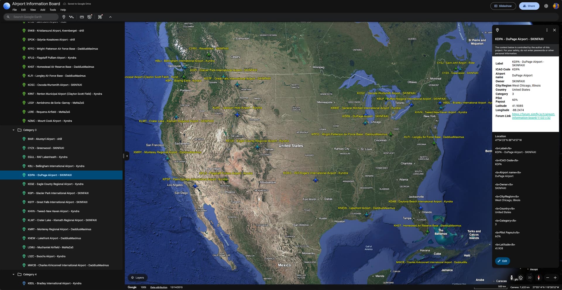
Click for interactive Airport Information Board map
image

If you would like to contribute, please use the template below to keep posts consistent. You can also use the provided ChatGPT prompt to help generate content.

You are responsible for anything you post - be sure to verify AI-generated information and hyperlinks before posting.

Example ChatGPT prompt:

Create an airport information post. Fill in accurate and relevant details for [ICAO and Airport Name]. Provide information that will be useful to simulation pilots and aviation enthusiasts. Include links to online airport resources, MSFS scenery (payware and freeware), XPlane gateway scenery, AirNav and SkyVector information pages, and a short introduction highlighting the airport’s features, operations, and any interesting facts.
Adhere the following rules:
Do not include bullets
Do not include reference links in the body output
List each runway on a separate line
Provide friendly text for hyperlinks
Provide Discuss markdown version at the end
Use the following formatting template:

[ICAO] - [Airport Name], [City/Region], [Country]

ICAO: [ICAO Code] 
SimFly category: [1-5]
Pilot payout: [e.g., 50%]
Location: [Geographic region or description] - [Working Google Maps hyperlink]
Runway(s): [Runway number, length ft X width ft / length m X width m]
Elevation: [altitude in ft / altitude in m]

Flightsim.to: [Link to MSFS freeware airport scenery, if available]
MSFS payware scenery: [Developer name and product link, if available]
XPlane gateway scenery: [Link to XPlane gateway scenery, if available]
SkyVector: [Links to charts or airport info]
AirNav: [Links to charts or airport info]
Other Resources: [Links to charts or airport info]

Introduction:
[Write a short paragraph introducing the airport.
You can include interesting facts, approach challenges, scenery highlights,
or why it's a favorite. Please keep it informative and aviation-focused.]

Looking forward to seeing your favorite airports featured—happy flying!

5 Likes

PAJN - Juneau International Airport, Alaska, USA

ICAO: PAJN
Category: 4
Pilot payout: 60%
Location: Alaska panhandle - Google Maps
Runway: 8/26 - 8,857 ft x 150 ft / 2700 m x 48 m

Details: SimFly | PAJN
Flightsim.to: PAJN - Juneau International Airport for Microsoft Flight Simulator
MSFS payware scenery: Northern Sky Studios - PAJN
AirNav: PAJN - Juneau International Airport
Other resources: Why Is Alaska’s Juneau International Airport So Challenging To Fly Into?
Official site: Airport – Homepage – City and Borough of Juneau

Introduction:

Now awaiting your arrival - PAJN - Juneau International Airport - Category 4.

Located in the Alaskan panhandle, this spectacular airport will make you earn that 60% pilot payout as it is one of the most challenging in the USA for commercial airline pilots - particularly in the frequently poor weather conditions. Both runway 8 and runway 26 present unique challenges.

Runway 8 features a 14 degree right offset LDA approach (approach course 71 degrees for runway oriented at 85 degrees) with sharp right turn required at the very end. From this direction, three sets of RLLS sequenced flashers extend out into the harbor to guide pilots along the correct approach path - similar to JFK’s Canarsie approach.

Approaches from the east to runway 26 deliver an entirely different set of challenges requiring a circling decent just above the treetops to avoid numerous nearby mountains.

Either way, you’ll feel a rush of excitement anytime Juneau shows up on your flight itinerary.

4 Likes

KEGE - Eagle County Regional Airport, Eagle, Colorado, USA

ICAO: KEGE - SimFly | Details
Category: 3
Pilot payout: 60%
Location: Colorado, USA - Google Maps
Runway: 07/25 – 9,000 ft x 150 ft / 2,743 m x 46 m
Elevation: 6547 ft / 1995 m

Details: SimFly | KEGE
MSFS payware scenery: Xometry Eagle County (KEGE) for MSFS-2020 – iniBuilds Store
Flightsim.to: KEGE - Eagle County Regional Airport (Gypsum, Colorado) for Microsoft Flight Simulator | MSFS
AirNav: KEGE - Eagle County Regional Airport

Introduction:

KEGE, Eagle County Regional airport in Colorado USA is now active and open for business! KEGE, Colorado’s 6th busiest airport, is the primary airport serving the world famous Vale ski resort and can accept aircraft as large as the 757.

The airport sits at an altitude of 6,547ft and features a 9,000ft runway with an interesting 3 degree offset precision approach to runway 25 (LDA with glideslope). Looking for even more of a challenge? Try one of the various approaches to runway 7 and experience firsthand why KEGE consistently ranks as one of the most challenging airports in the USA.

2 Likes

KBFI - Boeing Field, Seattle, Washington, USA

ICAO: KBFI
Category: 4 - SimFly | Details
Pilot payout: 60%
Location: Seattle, Washington, USA - Google Maps
Runways:
14R/32L – 10,007 ft x 200 ft / 3,050 m x 61 m
14L/32R – 3,709 ft x 100 ft / 1,131 m x 30 m

Details: SimFly | KBFI
Flightsim.to: Boeing Field, Seattle WA USA - KBFI
MSFS payware scenery: Drzewiecki Design - KBFI
AirNav: KBFI - Boeing Field/King County International Airport
Other: Official site

Introduction:

Located just a few miles north of KSEA and a few miles south of downtown Seattle, KBFI offers breathtaking views of one of the most beautiful regions of the United States. Take off from 14R on a clear day and be treated to a spectacular framing of Mount Rainier - one of the tallest mountains in the continental US. Take off from 32L and enjoy an amazing view of downtown Seattle on departure.

For those who adhere to realistic flight procedures, be ready for some extremely challenging airspace restrictions as KBFI lies directly beneath the approach path of Seattle-Tacoma International Airport (KSEA) with just a few thousand feet vertical clearance to the floor of the class bravo airspace.

Officially known as King County International Airport, Boeing Field is a public airport located just south of downtown Seattle, Washington. Opened in 1928, it was one of the earliest municipal airports in the United States and served as Seattle’s main passenger airport until the opening of Seattle-Tacoma International Airport in 1947. Named after aviation pioneer William E. Boeing, the field has historically been a hub for aircraft manufacturing and testing, particularly for The Boeing Company, which has used the site extensively for final delivery preparations and flight testing of commercial jets. Today, Boeing Field primarily serves general aviation, cargo operations, and corporate flights, and it remains an important facility for both aviation industry operations and regional air traffic.

2 Likes

KBLI - Bellingham International Airport, Washington, USA

ICAO: KBLI
Category: 3 - SimFly | Details
Pilot payout: 60%
Location: Bellingham, Washington, USA - Google Maps
Runway: 16/34 – 6,700 ft x 150 ft / 2,042 m x 46 m

Details: SimFly | KBLI
Flightsim.to: KBLI Bellingham, WA for Microsoft Flight Simulator | MSFS
MSFS payware scenery: Fly 2 High - KBLI
AirNav: KBLI - Bellingham International Airport

Introduction:

Bellingham International Airport (BLI) serves as a convenient gateway for travelers in the Pacific Northwest, especially those from Canada. Situated approximately 49 miles (79 km) south of Vancouver, British Columbia, it offers a practical alternative to Vancouver International Airport (YVR), particularly for Canadians seeking more affordable domestic flights. The airport’s proximity to the U.S.-Canada border has made it a popular choice for cross-border travelers.

Beyond its role in air travel, Bellingham International Airport is surrounded by some of the most breathtaking natural landscapes in the region. To the east, Mount Baker, a towering 10,781-foot (3,286-meter) active volcano, dominates the skyline. North of the airport, Mount Shuksan rises to 9,131 feet (2,783 meters), renowned for its striking appearance and glaciated features. The area is a haven for outdoor enthusiasts, offering opportunities for hiking, skiing, and photography. Notably, Picture Lake near the end of State Route 542 provides one of the most photographed scenes in the country, with a mirror-like reflection of Mount Shuksan.

Whether you’re flying in or out, Bellingham International Airport offers more than just air travel—it provides a front-row seat to some of the most stunning mountain vistas in the Pacific Northwest.

2 Likes

KRNT - Renton Municipal Airport (Clayton Scott Field), Washington, USA

ICAO: KRNT
Category: 2
Pilot payout: 60%
Location: Renton, Washington, USA – Google Maps
Runway: 16/34 – 5,382 ft x 200 ft / 1,640 m x 61 m

Details: SimFly | KRNT
Flightsim.to: Renton Municipal Airport, Renton WA USA
MSFS payware scenery: Drzewiecki Design – KRNT
AirNav: KRNT – Renton Municipal Airport

Introduction:

Renton Municipal Airport, also known as Clayton Scott Field, is a public-use general aviation airport located in Renton, Washington, approximately 12 miles southeast of downtown Seattle. Situated on the southern shore of Lake Washington, the airport supports both land-based and seaplane operations with facilities including a floating dock and a launching ramp. Its close proximity to the Boeing Renton Factory—home of the 737 production line—makes it a key component in the Pacific Northwest’s aviation ecosystem. KRNT primarily serves general aviation, corporate flights, and air taxi operations, and is a vital regional reliever airport for Seattle-Tacoma International.

If you elect to install the Microsoft Flight Simulator (MSFS) add-on scenery by Drzewiecki Design, be prepared to be blown away by the level of detail. Drzewiecki has fully modeled and animated the entire 737 production line! You can go inside the buildings and witness the assembly and painting of Boeing 737 - Max aircraft.

2 Likes

KFLG - Flagstaff Pulliam Airport, Arizona, USA

ICAO: KFLG
Category: 2 - SimFly | Details
Pilot payout: 60%
Location: Flagstaff, Arizona, USA – Google Maps
Runway: 03/21 – 8,800 ft x 150 ft / 2,682 m x 46 m

Details: SimFly | KFLG
MSFS payware scenery: UK2000 Scenery – KFLG
Flightsim.to: Flagstaff Pulliam Airport KFLG for Microsoft Flight Simulator | MSFS
AirNav: KFLG - Flagstaff Pulliam Airport

Introduction

Flagstaff Pulliam Airport (KFLG) is a regional airport serving the city of Flagstaff, Arizona, located just 5 miles south of downtown. Originally built in the 1940s, the airport has grown into an important air travel hub for northern Arizona. Its single 8,800-foot runway accommodates both commercial and general aviation traffic, with regional flights connecting passengers to major hubs like Phoenix and Dallas. The airport’s high elevation—over 7,000 feet above sea level—offers a unique flying environment with stunning views of the nearby San Francisco Peaks.

KFLG supports a wide variety of aviation services including corporate jets, flight training, and charter operations. Its location makes it a convenient gateway to Grand Canyon National Park, Sedona, and other Northern Arizona attractions. Pilots flying into Flagstaff are treated to scenic approaches and clean air typical of the Colorado Plateau region.

2 Likes

KPSP - Palm Springs International Airport, California, USA

ICAO: KPSP
Category: 4 - SimFly | Details
Pilot payout: 60%
Location: Palm Springs, California, USA – Google Maps
Runways:
13R/31L – 10,000 ft x 150 ft / 3,048 m x 46 m
13L/31R – 4,953 ft x 100 ft / 1,509 m x 30 m

Details: SimFly | KPSP
Flightsim.to: N/A
MSFS 2024 payware scenery: iniBuilds - KPSP for MSFS 2024
MSFS 2020 payware scenery: iniBuilds - KPSP for MSFS 2020
AirNav: KPSP - Palm Springs International Airport

Introduction

Palm Springs International Airport (KPSP) serves as the primary commercial airport for the Coachella Valley in Southern California. Located just 2 miles northwest of downtown Palm Springs, the airport is a popular gateway for both leisure and business travelers heading to the desert resort city and surrounding communities. The airport features two asphalt runways: the main runway 13R/31L, which is 10,000 feet long, accommodating large commercial jets, and a secondary runway 13L/31R, which is 4,953 feet long for smaller general aviation aircraft.

KPSP supports a mix of commercial airline service, general aviation, and cargo operations. Its location near popular destinations such as Joshua Tree National Park, Palm Desert, and the greater Riverside County area makes it an important regional hub. The airport experiences a seasonal surge in traffic, especially during the winter months, attracting visitors seeking sunny weather and outdoor recreation. Pilots flying into KPSP enjoy scenic approaches over the San Jacinto Mountains and the surrounding desert landscape.

2 Likes

EPOK – Gdynia-Kosakowo Airport, Poland

  • ICAO: EPOK
  • Category: Military
  • Pilot Payout: 20%
  • Airporti tier / level: Tier 2 / Level 5
  • Location: Gdynia, Pomeranian Voivodeship, Poland – Google Maps
  • Runway 13/31: 8,202 ft (2,500 m)
  • Runway 08/26: 2,592 ft (790 m)
  • MSFS Payware Scenery: EPOK (MSFS 2020/2024) by wlodi flightsim.to

Introduction

Gdynia-Kosakowo Airport (ICAO: EPOK) is a military airfield located approximately 7 km south of Gdynia, Poland, in the Pomeranian Voivodeship. Situated at an elevation of 148 feet (45 meters) above sea level, the airport serves as a base for the Polish Armed Forces. It features two runways: Runway 13/31, measuring 8,202 feet (2,500 meters) in length, and Runway 08/26, which is 2,592 feet (790 meters) long. The longer runway accommodates various military aircraft operations.Microsoft Flight Simulator Forums+1AC-U-KWIK+1SkyVector

EPOK is equipped with modern facilities, including a control tower operating 24/7, and provides services such as customs and fuel (jet fuel only). The airport is open to international flights, though it requires prior permission for civil aircraft operations. The airport’s strategic location near the Baltic Sea and its proximity to Gdynia make it an essential asset for Poland’s defense infrastructure.

Please note that while EPOK is open to international flights, civil aircraft operations.

2 Likes

BIAR – Akureyri Airport, Iceland
ICAO: BIAR
IATA: AEY
Category: Tier 3 / level 3
Pilot Payout: 20%
Location: Akureyri, North Iceland – Google Maps
Runway 01/19: 2,400 m (7,874 ft) – Asphalt
MSFS Payware Scenery: ST Simulations – BIAR
Flightsim.to: BIAR – Akureyri
AirNav: BIAR – Akureyri Airport


Introduction

Akureyri Airport (IATA: AEY, ICAO: BIAR) is an international airport located approximately 3 km south of Akureyri, Iceland’s second-largest urban area. Situated on the delta of the Eyjafjörður river, the airport serves as a vital gateway to North Iceland and the Arctic region. The airport’s single asphalt runway (01/19) measures 2,400 meters (7,874 feet) in length, accommodating various aircraft types.

Scheduled air services connect Akureyri to several domestic destinations within Iceland, including Reykjavík, Grimsey Island, Thorshofn, and Vopnafjordur. Additionally, seasonal international flights are operated by airlines such as easyJet, Edelweiss Air, and Transavia .

The airport is also home to the Icelandic Aviation Museum, which features a collection of historical aircraft and aviation artifacts. A notable exhibit includes a decommissioned Boeing 757-200 from Icelandair, which is set to be displayed at the museum .

For virtual pilots, ST Simulations offers a detailed payware scenery of Akureyri Airport for Microsoft Flight Simulator. This add-on includes accurate runway and apron layouts, custom static aircraft models (such as the DC-3 and DC-6), and high-quality textures with PBR materials .

It is a spectacular location (way better than BIKF) and quite challenging approach so you have to try it at least once.


2 Likes

ENKB – Kristiansund Airport, Kvernberget, Norway


Introduction

Kristiansund Airport, Kvernberget (ICAO: ENKB, IATA: KSU) is an international airport located in Kristiansund, Møre og Romsdal county, Norway. Situated on the island of Nordlandet, the airport serves as the primary gateway to the Nordmøre region. It features a single asphalt runway (07/25) measuring 6,037 feet (1,840 meters) in length, accommodating various aircraft types.

Operated by Avinor, ENKB handles both scheduled commercial flights and offshore helicopter traffic. Scandinavian Airlines provides daily services to Oslo, while Widerøe operates flights to Bergen. Additionally, the airport supports helicopter operations to the Norwegian Sea, serving the oil and gas industry.

Please note that while Kristiansund Airport is open to international flights, civil aircraft operations require prior permission. Pilots should ensure they have the necessary clearances before planning a flight to or from this airport.

EGUL - RAF Lakenheath, Suffolk, England

ICAO: EGUL
SimFly category: 3
Pilot payout: 60%
Location: East Anglia, United Kingdom – View on Google Maps
Runway: 06/24 – 9,000 ft x 150 ft / 2,743 m x 46 m

Details: SimFly | EGUL
Flightsim.to: RAF Lakenheath Scenery - USAF 48th FW - Version 1.2 for Microsoft Flight Simulator | MSFS
MSFS payware scenery: IM Scenery - Lakenheath Air Base EGUL for MSFS20/24
XPlane gateway: RAF Lakenheath
SkyVector: RAF Lakenheath on SkyVector
AirNav: EGUL AirNav Info
Other Resources: Home page of Royal Air Force Lakenheath

Introduction:

Welcome military pilots, commercial aviators, and weekend GA fans!

RAF Lakenheath is a unique airfield in Suffolk, England that, despite its Royal Air Force designation, is currently home exclusively to United States Air Force personnel and operations.

It stands as the largest U.S. fighter presence in Europe, hosting the 48th Fighter Wing and its four squadrons of F-15E Strike Eagles and F-35A Lightning II aircraft. This highly strategic installation is a cornerstone of NATO’s forward-deployed strength and a hotbed of advanced fighter training and rapid deployment readiness.

This is one of the USAF’s most important airbases worldwide…if you know…you know.

2 Likes

KDAB - Daytona Beach International Airport, Daytona Beach, Florida, United States

ICAO: KDAB
SimFly category: 4
Pilot payout: 60%
Location: East Central Florida – View on Google Maps
Runways:
07L/25R – 10,500 ft x 150 ft / 3,200 m x 46 m
07R/25L – 3,195 ft x 75 ft / 974 m x 23 m
16/34 – 6,001 ft x 150 ft / 1,829 m x 46 m

Details: SimFly | KDAB
Flightsim.to: Daytona Beach International Airport - KDAB for Microsoft Flight Simulator | MSFS
MSFS payware scenery: BMWorld and AmSim Release KDAB - Threshold
XPlane gateway: X-Plane Scenery Gateway - KDAB
SkyVector: Daytona Beach Intl on SkyVector
AirNav: KDAB AirNav Info
Other Resources: FlightAware Live KDAB Tracker

Introduction:
Daytona Beach International Airport is a bustling Florida hub that offers a bit of everything—from airline service to GA, military operations, and even student flight training. Home to Embry-Riddle Aeronautical University, the airport sees a massive volume of daily training flights, making it one of the most active airspaces in the U.S. Despite this, KDAB maintains a relaxed and efficient operational environment, ideal for sim pilots of all experience levels. Its proximity to the Daytona International Speedway adds a unique local flavor, especially during major racing events when charter and business jet traffic spikes. With three runways and excellent ATC coverage, Daytona is a great destination or launch point for Florida and East Coast flying adventures.

2 Likes

EGAR - Rothera Research Station, Adelaide Island, Antarctica

ICAO: EGAR
SimFly category: 1 Simfly details
Aircraft Categories not allowed: 5, 6, 7
Pilot payout: 20%
Location: Rothera Point, Adelaide Island, Antarctic Peninsula – View on Google Maps
Runway(s):
18/36 – 2,953 ft x 98 ft (900 m x 30 m) – Crushed rock

Flightsim.to: EGAR - Rothera Research Station - Antarctica
MSFS payware scenery: Aerosoft – EGAR Antarctica Rothera
X-Plane Gateway scenery: EGAR on X-Plane Scenery Gateway
AirNav: EGAR - Rothera Research Station - AirNav Radar Flight Tracker
Other Resources: Metar-Taf.com, Flight Plan Database

Introduction:
Rothera Research Station (EGAR) is the principal British Antarctic Survey (BAS) facility located on Adelaide Island, serving as a critical hub for scientific research and logistics in the Antarctic region. The station features a single 900-meter crushed rock runway, primarily accommodating aircraft like the de Havilland Canada Dash 7 and Twin Otters, which are specially equipped for polar operations. Pilots operating in and out of EGAR face unique challenges, including rapidly changing weather conditions, limited navigational aids, and the presence of icebergs that can obstruct approaches. For flight simulation enthusiasts, EGAR offers a distinctive and immersive experience, with detailed scenery available for both Microsoft Flight Simulator and X-Plane platforms, capturing the stark beauty and operational intricacies of this remote Antarctic outpost.


2 Likes

SCRM - Teniente Rodolfo Marsh Martin Airport, King George Island, Antarctica

ICAO: SCRM
SimFly category: 1 Simfly details
Aircraft Categories not allowed: 5, 6, 7
Pilot payout: 20%
Location: King George Island, Antarctic Peninsula – View on Wikipedia
Runway(s):
11/29 – 4,239 ft x 125 ft (1,292 m x 38 m) – Gravel

Flightsim.to: Teniente Rodolfo Marsh Martin Airport for MSFS
MSFS payware scenery: Aerosoft – Antarctica Vol. 1: British Rothera and Chilean Marsh Airfields
X-Plane Gateway scenery: SCRM on X-Plane Scenery Gateway
SkyVector: SCRM – Teniente Rodolfo Marsh Martin Airport
AirNav: SCRM – Teniente Rodolfo Marsh Martin Airport
Other Resources: Metar-Taf.com, Flight Plan Database

Introduction:
Teniente Rodolfo Marsh Martin Airport (SCRM) is Chile’s principal gateway to Antarctica, located on King George Island. It serves the nearby village of Villa Las Estrellas and the Base Presidente Eduardo Frei Montalva. The airport features a single gravel runway measuring 1,292 meters, accommodating aircraft like the C-130 Hercules and DHC-6 Twin Otter. Pilots operating here face unique challenges, including rapidly changing weather conditions, limited navigational aids, and the presence of icebergs that can obstruct approaches. Read about a real flying experience in Antarctica here

1 Like

LIPG - Gorizia “Amedeo Duca d’Aosta” Airport, Gorizia, Italy

ICAO: LIPG
SimFly category: 1 SimFly | Details
Aircraft Categories not allowed: 5, 6, 7
Pilot payout: 20%
Location: Gorizia, Friuli-Venezia Giulia, Italy – View on Google Maps
Runway(s):
09/27 – 3,591 ft x 98 ft (1,094 m x 30 m) – Grass
04L/22R – 2,297 ft x 98 ft (700 m x 30 m) – Grass
04R/22L – 2,297 ft x 98 ft (700 m x 30 m) – Grass

Flightsim.to: LIPG – Gorizia Airfield & Pipistrel Factory
MSFS payware scenery: None available
X-Plane Gateway scenery: LIPG on X-Plane Scenery Gateway
SkyVector: LIPG – Gorizia Airport
AirNav: LIPG – Gorizia Airport
Other Resources: Metar-Taf.com, Flight Plan Database

Introduction:
Gorizia “Amedeo Duca d’Aosta” Airport (LIPG) is a historic airfield located in the Friuli-Venezia Giulia region of northeastern Italy. Established in 1911, it has served various roles over the years, including military operations and general aviation. Today, it is primarily used for recreational flying, flight training, and hosts the Pipistrel aircraft factory, known for producing innovative light aircraft. The airport features three grass runways, accommodating a variety of light aircraft operations. For flight simulation enthusiasts, LIPG offers a unique flying experience with detailed freeware scenery available for Microsoft Flight Simulator, capturing the charm and historical significance of this regional airfield.
Official page here

2 Likes

LFKJ - Ajaccio Napoléon Bonaparte Airport, Corsica, France

ICAO: LFKJ
SimFly category: 4 SimFly | Details
Pilot payout: 60%
Location: Western coast of Corsica, Mediterranean Sea - View on Google Maps

Runway(s):
02/20 - 7,228 ft x 148 ft (2,203 m x 45 m)

Flightsim.to: Freeware MSFS scenery by jolouv
MSFS payware scenery: PILOT EXPERIENCE SIM
XPlane gateway scenery: X-Plane Gateway LFKJ Scenery
SkyVector: LFKJ on SkyVector
AirNav: LFKJ Info (AirNav Europe)
Other Resources: Charts from SIA France

Introduction:
Ajaccio Napoléon Bonaparte Airport (LFKJ) is a scenic and dynamic destination located on the west coast of Corsica. Its main runway 02/20 serves a mix of commercial, general aviation, and seasonal charter traffic. What makes LFKJ particularly appealing to simulator pilots is the challenging RNAV approach to runway 20. This procedure guides aircraft through a winding descent over the sea and rugged terrain, requiring precision and attention to minima. The final segment offers a stunning view of the Corsican coastline before aligning with the runway—making it a rewarding experience for those who enjoy non-precision approaches in complex environments.

Official page here

1 Like

CYSJ Saint John Airport, Saint John N.B., Canada

ICAO: CYSJ -SimFly | Fly and Earn
Category: 2
Pilot payout: 20%
Location: Saint John N.B. - Google Maps

Runway: 05/23 7,201ft 2,195m Asphalt
Runway: 14/32 5,100ft 1,554m Asphalt

AirNav: CYSJ - St John Airport
Official page https://ysjsaintjohn.ca/

Introduction:
Saint John Airport is a Canadian airport in Saint John, New Brunswick. Located about 8 nautical miles east northeast of Uptown Saint John, in an area formerly known as Clover Valley, the airport serves the city of Saint John, the Greater Saint John metropolitan area, and the southern region of New Brunswick.

2 Likes

KOKC - Will Rogers International Airport, Oklahoma City, Oklahoma, United States

ICAO: KOKC
SimFly category: 4
Airport level: 2
Pilot payout: 60%
Location: Central Oklahoma - View on Google Maps
Runway(s):
17L/35R – 9802 x 150 ft / 2988 x 46 m
17R/35L – 7800 x 150 ft / 2377 x 46 m
13/31 – 7701 x 150 ft / 2347 x 46 m

Details: SimFly | KOKC
Flightsim.to: N/A
MSFS payware scenery: iniBuilds Oklahoma City (KOKC) for MSFS-2020
XPlane gateway scenery: X-Plane Scenery Gateway for KOKC
SkyVector: KOKC Charts and Info on SkyVector
AirNav: AirNav Info for KOKC
Other Resources: KOKC official site

Introduction:
Will Rogers International Airport (formerly known as Will Rogers World Airport) is the primary commercial airport serving Oklahoma City and the surrounding region. Named after famed entertainer and aviator Will Rogers, the airport is a hub of both civilian and military aviation activity. KOKC features three runways capable of supporting large commercial aircraft, with 17L/35R being the longest. Its central U.S. location makes it a key alternate during weather diversions and a favorite for cross-country flights. For flight simulation pilots, KOKC offers a mix of commercial airline traffic, general aviation, and military operations from nearby Tinker AFB. Navigating the intersecting runways and occasional strong crosswinds provides a rewarding challenge. With high-quality freeware and payware scenery available, it’s a fantastic airport for both short regional hops and long-haul operations.

3 Likes

KBDL - Bradley International Airport, Windsor Locks, Connecticut, United States

ICAO: KBDL
SimFly category: 4
Pilot payout: 60%
Location: Northern Connecticut, New England region - View on Google Maps

Runway(s):
06/24, 9,510 ft x 200 ft / 2,899 m x 61 m
15/33, 6,847 ft x 150 ft / 2,087 m x 46 m

Details: SimFly | KBDL
Flightsim.to: KBDL Runway Layout Update Only
MSFS payware scenery: LatinVFR Hartford- Bradley Int’l KBDL MSFS
XPlane gateway scenery: X-Plane Scenery Gateway for KBDL
SkyVector: View Bradley Airport on SkyVector
AirNav: View KBDL on AirNav
Other Resources: Official site | BDL | Love the Journey!

Introduction:
Bradley International Airport (KBDL) serves as the second-busiest airport in New England, providing a crucial link between the Hartford-Springfield metropolitan area and destinations across the U.S. and internationally. It is a joint civil-military airport, housing the 103rd Airlift Wing of the Connecticut Air National Guard. KBDL is known for its long runways, capable of handling wide-body aircraft and cargo operations, and for being a popular alternate airport for transatlantic flights in poor weather.

If you opt for the LatinVFR MSFS payware scenery, be prepared to be pleasantly surprised as KBDL is one of LVFR’s best efforts to date including nice details like animated radar, 3D modeled runway surface cracks, and partially modeled terminal interior.

2 Likes