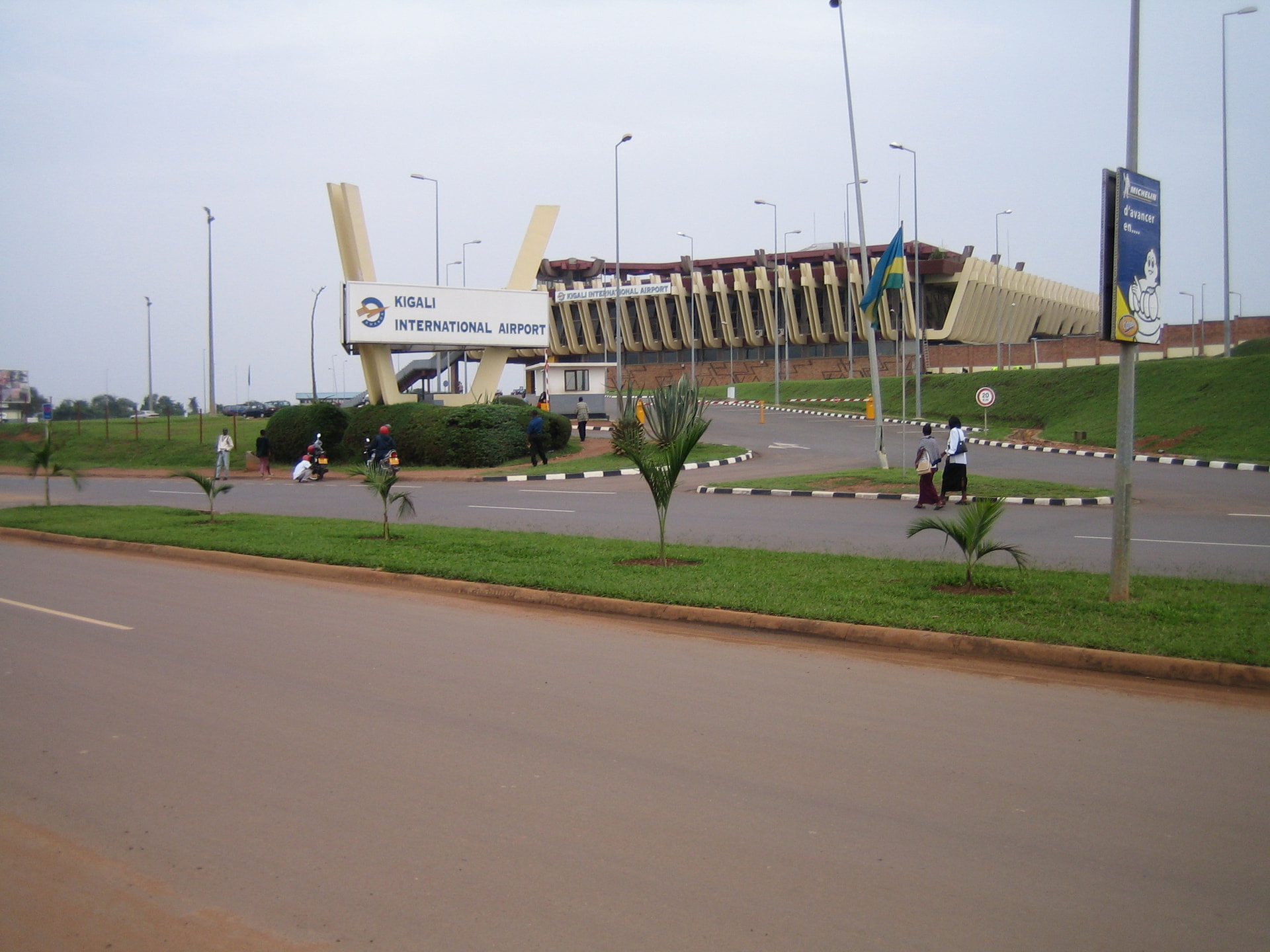
The airport operates as a public civil airport, with customs/immigration — functioning as a point of entry and exit. acukwik.com+2airportnavfinder.com+2
Offers both domestic and international flights (in past data, it served flights to domestic destinations and European destinations, e.g. France). airports-worldwide.com+1
Historical / Contextual Notes
The airport originally opened for national flights; later expanded to support international traffic. airports-worldwide.com+1
It is also known simply as Bejaia Airport (BJA), or just “Soummam Airport”.
Importante: Pista muy larga y con ILS en ambas cabezera
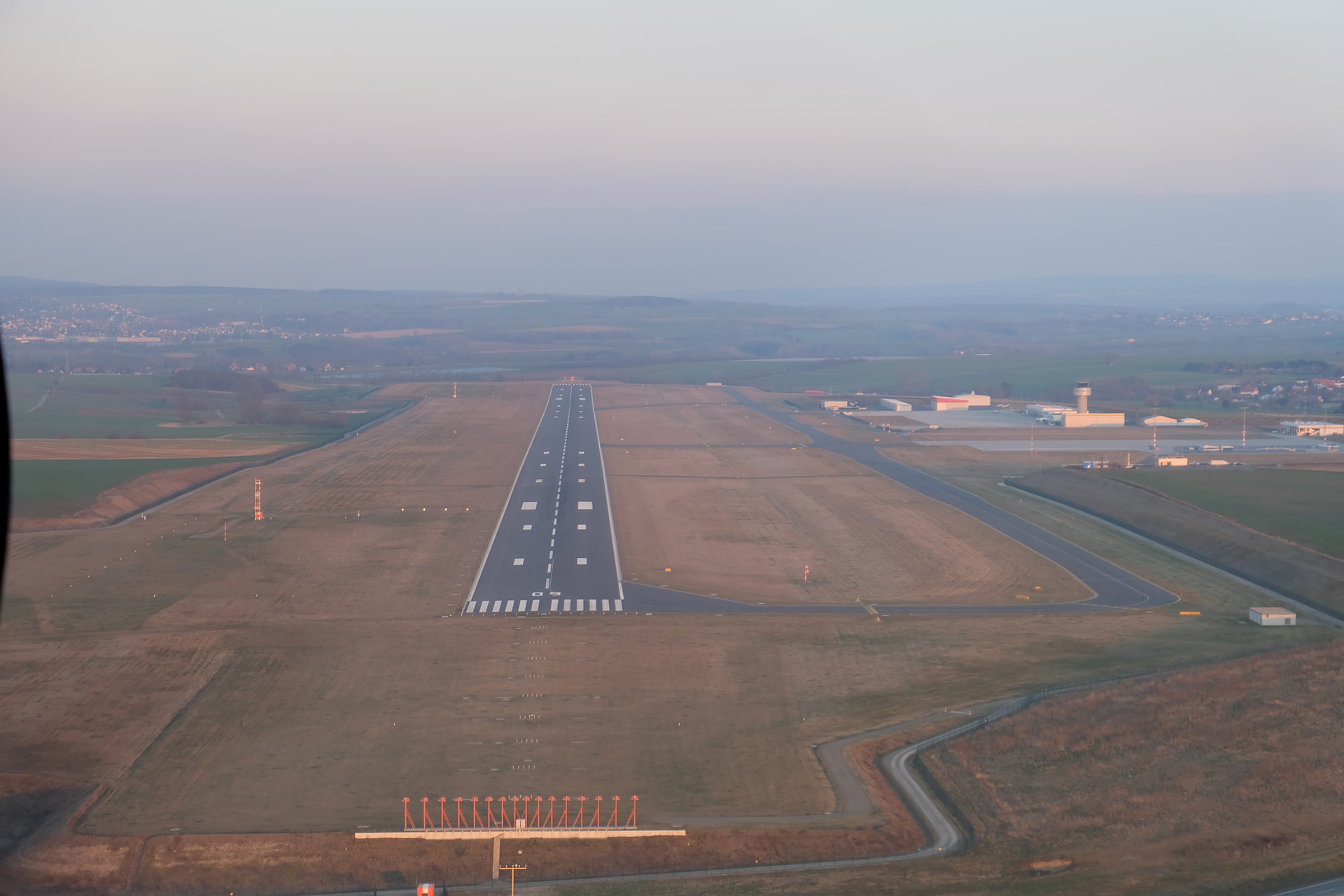
Es una alegria compartir mi segundo aeropuerto EDVK en Alemania, son todos bienvenidos con pista ILS en ambas cabezeras. El Aeropuerto de Kassel-Calden, situado cerca de Kassel, en el estado federado de Hesse, Alemania, funciona como aeropuerto regional y atiende vuelos nacionales e internacionales. Ubicado a una altitud de 260 metros, el aeropuerto está diseñado para operar vuelos comerciales, generales y chárter. Las instalaciones de Kassel-Calden incluyen una moderna terminal con servicios esenciales para los pasajeros, lo que contribuye a una experiencia de viaje cómoda. La pista está bien equipada para recibir diversos tipos de aeronaves. El Aeropuerto de Kassel-Calden desempeña un papel fundamental en la conectividad de la región, apoyando tanto a la comunidad local como al sector económico en general mediante la mejora de la accesibilidad y las opciones de transporte.
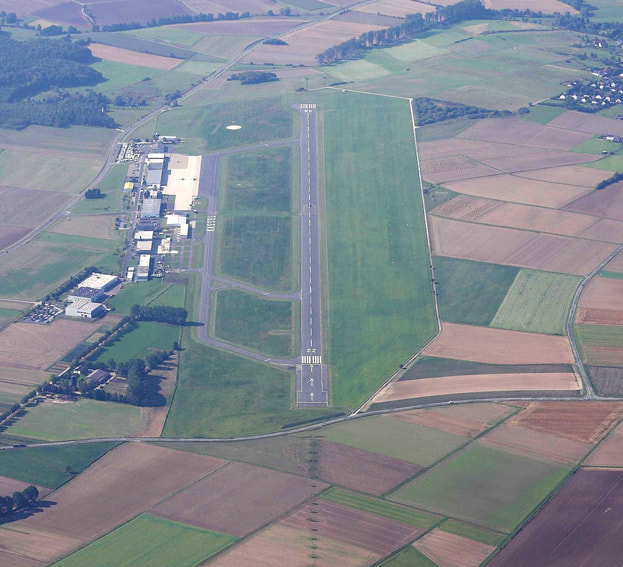
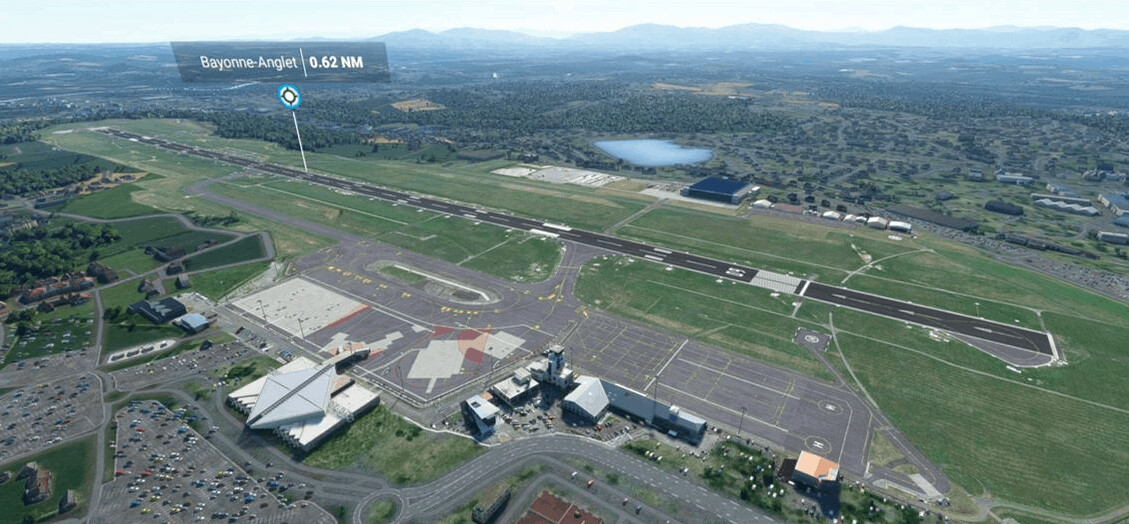
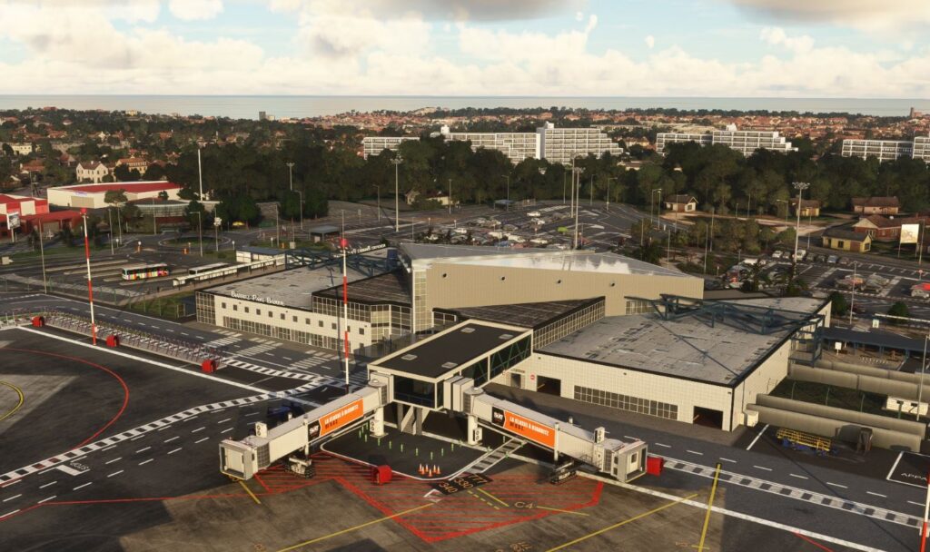
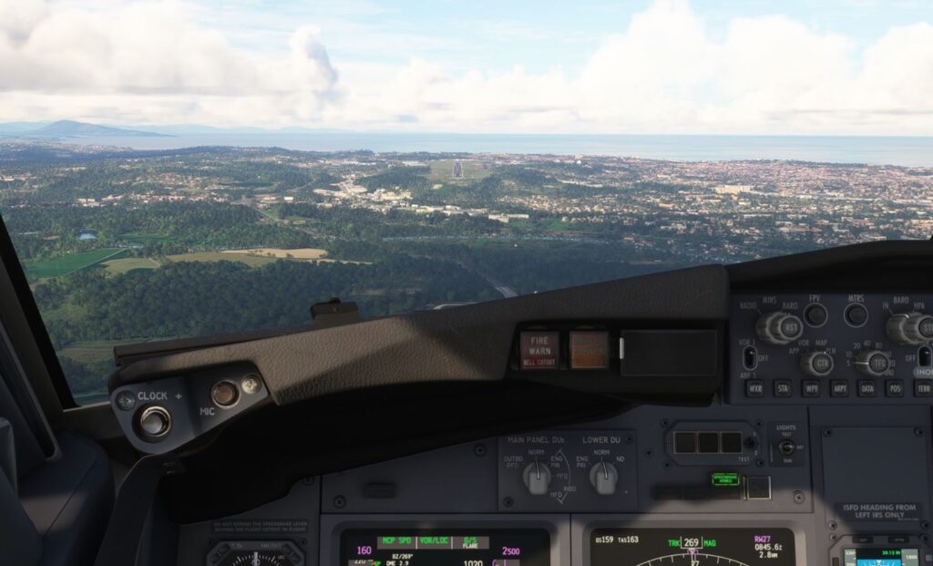
Name: also known as Biarritz - Pays Basque Airport
IATA: BIQ
Location: It is located 5 km southeast of Biarritz (France) between the Gulf of Vizcaya and the Atlantic Pyrenees, it is also 25km from Irùn Spanish border.
Altitude: ~ 245 feet (≈ 75 m) .
Infrastructures: runways and operations
Details
Runway(s): 09/27, 7382 ft × 148 ft / 2,250 m × 45 m with ILS approach (27) and RNAV RNP (09)
Description: YPXM is the ICAO code for Christmas Island Airport, an airport located on Christmas Island, an external territory of Australia in the Indian Ocean. It is a public airport with one asphalt runway (18/36) measuring 2,103 meters (6,900 feet). It is situated about 2,600 km northwest of Perth, 500 km south of Jakarta, and 975 km east-northeast of the Cocos (Keeling) Islands.
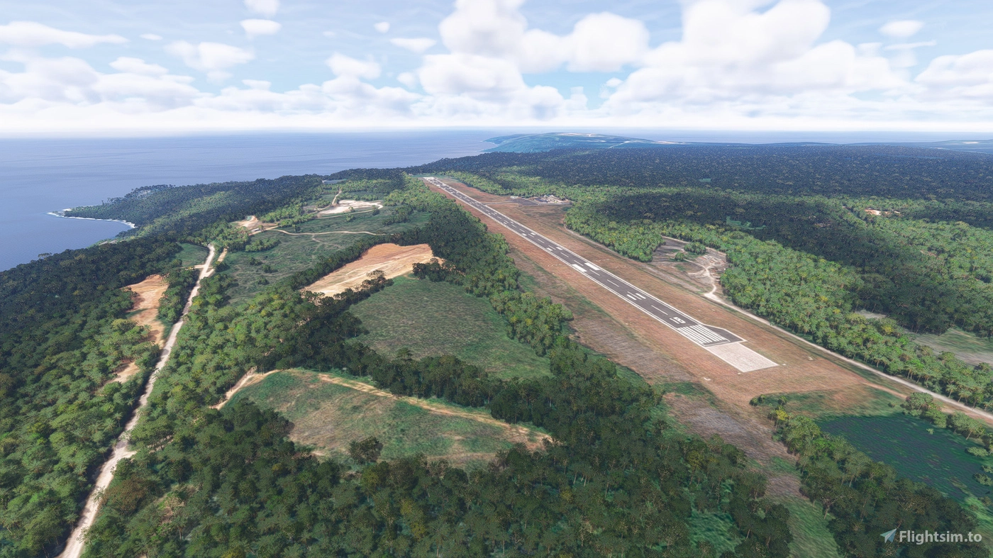
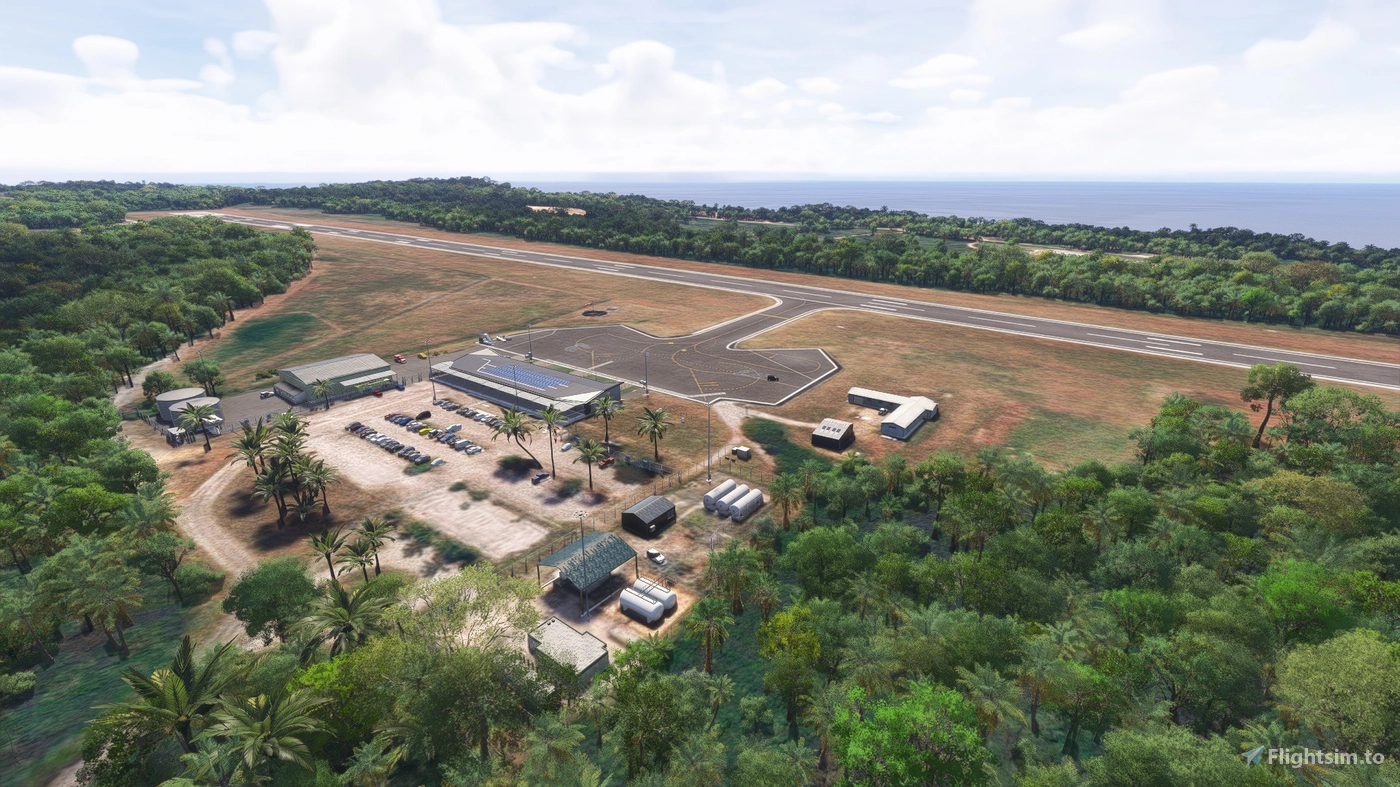
ICAO : FYWH SimFly catégorie : 4 Payout pilote : 60% Localisation : Est de Windhoek, désert namibien
Piste :
08 / 26 — 4,491 m × 45 m
ILS + RNAV
Élévation :5,640 ft (haute altitude)
Description :
FYWH possède l’une des plus longues pistes d’Afrique : idéale pour très gros porteurs (B747 cargo, B777, A350).
Terrain élevé, isolé, entouré de paysages désertiques spectaculaires.
Les approches au lever/coucher du soleil sont incroyables. Un hub parfait pour long-courrier, cargo et routes africaines premium.
HKJK est l’un des hubs majeurs du continent africain. Sa piste massive de plus de 4 km accepte tous les appareils : A380, B747, B777, A350.
Son altitude élevée ajoute un vrai challenge aux performances avion.
Proche du Mont Kenya et des grandes réserves naturelles, c’est un aéroport parfait pour long-courriers premium et safaris aériens.
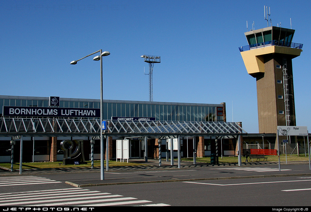
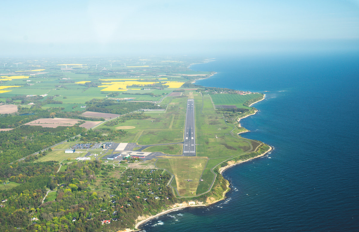
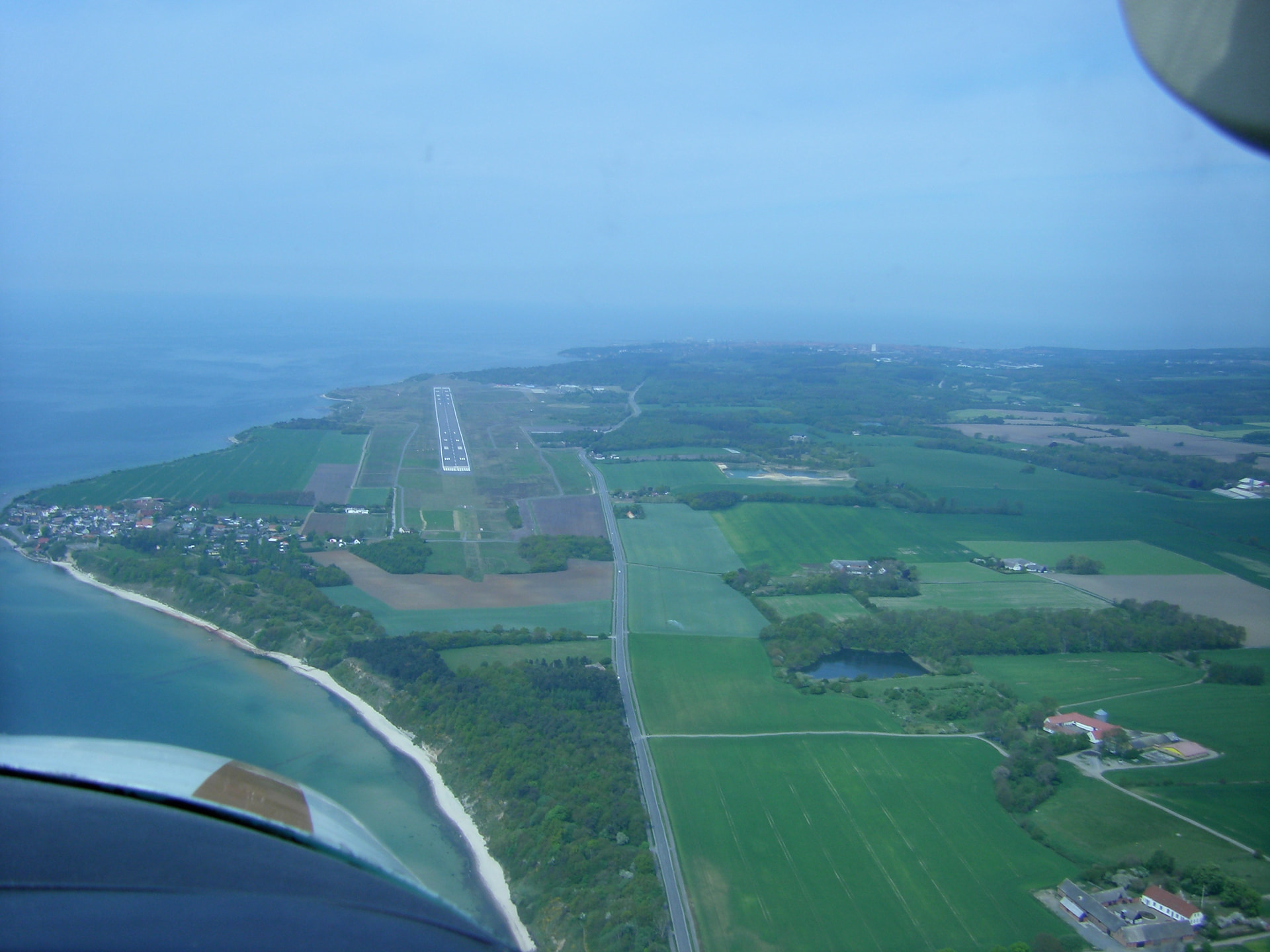
Location: It is located on the island of Bronholm, 5 km southeast of Ronne town. Bronholm is an island located in the Baltic Sea, at east of Denmark, south of Sweden and at north from Poland and Germany.
Altitude: ~ 52 feet (≈ 16 m) .
Infrastructures: runways and operations
Details
Runway(s): 11/29, 6568 ft × 148 ft / 2,002 m × 45 m with ILS approach in both sides of the runway
Ronne Airport is one of the 6 Danish International airports.
History/sceneries
In 1935, representatives of Rigsdagen, Rønne municipality and Det Danske Luftfartsselskab (DDL) − later a part of Scandinavian Airlines System − agreed to establish an air connection between Rønne and Copenhagen. The following year A/S Den bornholmske Flyveplads was founded, with airport construction beginning in 1937. Two years later the first route commenced on a temporary licence from the air transport inspectorate.
The airport has a free update scenery from Microsoft in msfs2020 with WU5 and is one of handcrafted scenery if you have msfs2024.
ICAO: LEAS
SimFly category: 4
Pilot payout: 60%
Location: Principado de Asturias, Castrillón (parroquia Santiago del Monte) – [Google Maps]
Runway(s): 11/29, 7,218 ft × 148 ft / 2,200 m × 45 m
Elevation: 416 ft / 127 m
Introduction:
El Aeropuerto de Asturias (LEAS) es la puerta aérea del Principado de Asturias, situado en Castrillón, a unas decenas de kilómetros de Oviedo, Gijón y Avilés. Su pista 11/29 de 2,200 m lo hace manejable para aviones comerciales medianos, siendo frecuente ver A320, A319 o similares. El entorno costero y la orografía de la región pueden generar niebla y vientos cambiantes, lo que convierte los enfoques en un reto agradable para pilotos de simulación que busquen realismo. A su favor tiene un ambiente típico del norte de España, con naturaleza cercana, lo que lo hace un destino atractivo tanto para vuelos domésticos como para practicar aproximaciones IFR o VFR.
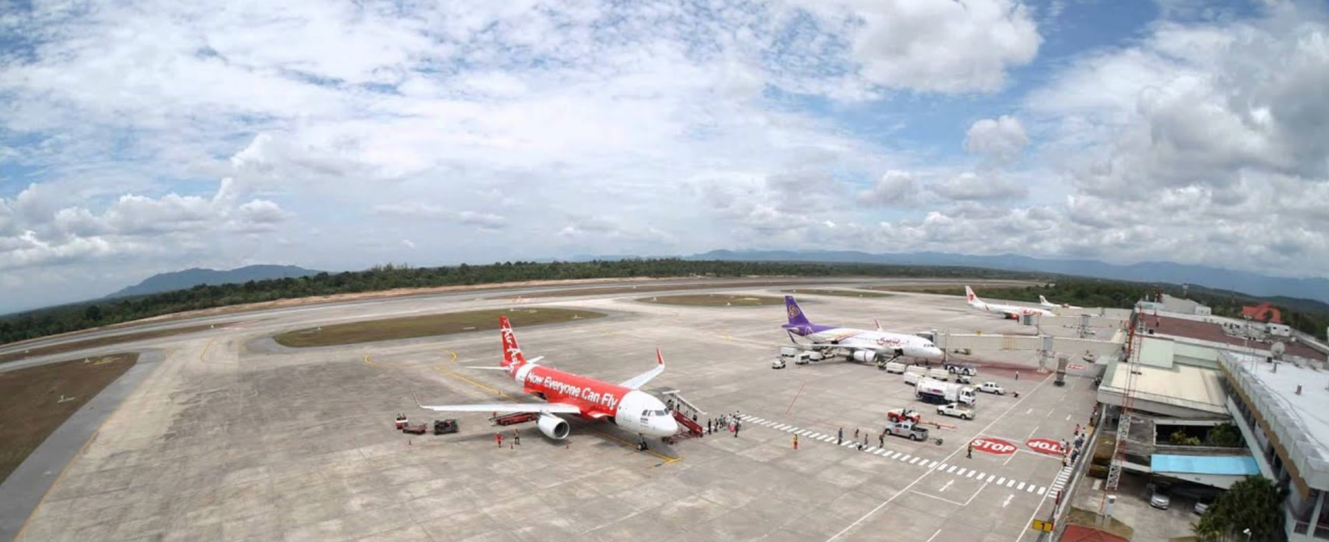
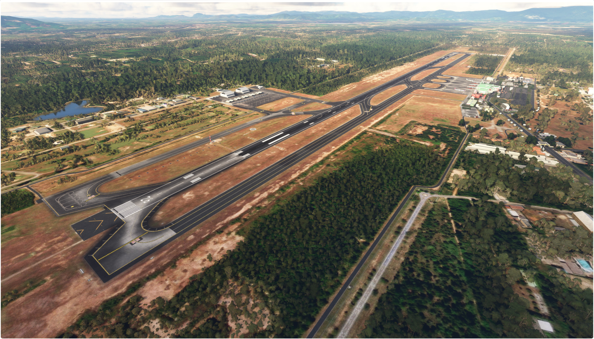
Hat Yai International Airport (VTSS) is the main air gateway for southern Thailand’s Songkhla province and the city of Hat Yai. With a single long 3,050 m runway capable of handling international traffic and wide-body jets, VTSS services over 3 million passengers annually — making it one of Thailand’s busiest regional airports. The field supports both IFR and VFR operations, with ILS, VOR/DME and NDB approaches available.
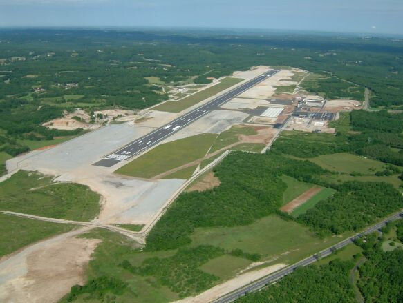
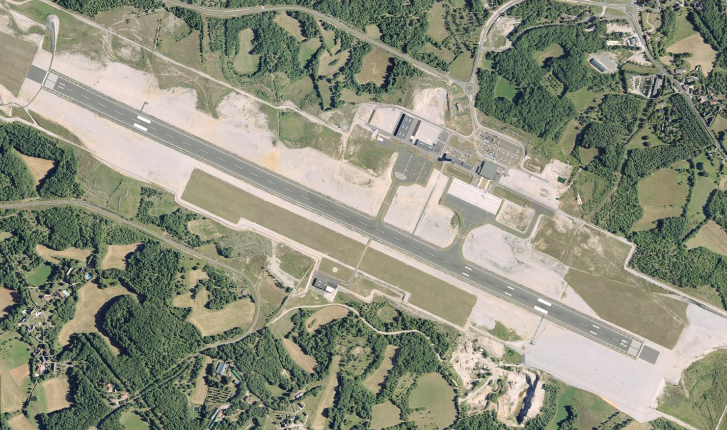
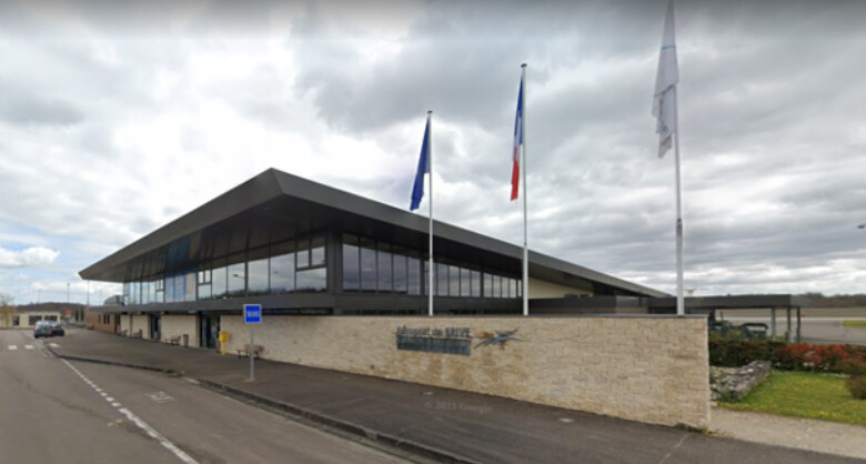
Introduction: Brive–Souillac Airport (IATA: BVE, ICAO: LFSL), also Brive–Dordogne Valley Airport (French: Aéroport de Brive – Vallée de la Dordogne), is an international airport located 13 kilometres (7.0 NM) south of Brive-la-Gaillarde, a commune of the Corrèze department in the Nouvelle-Aquitaine region of France.The airport caters for tourist movements into the Dordogne area.
LERM – Robledillo de Mohernando Airfield, Guadalajara, Spain
ICAO: LERM
SimFly category: 2
Pilot payout: 60%
Location: Robledillo de Mohernando, Guadalajara
Runway(s): 09/27, approx. 2,300 ft × 98 ft / 700 m × 30 m (dirt/grass)
Elevation: 3,002 ft / 915 m
Introduction:
Robledillo de Mohernando Airfield (LERM) is a charming rural VFR field with a dirt/grass runway and wide open terrain, making it a great choice for ultralight flights, casual VFR navigation, and seasonal runway-surface challenges.
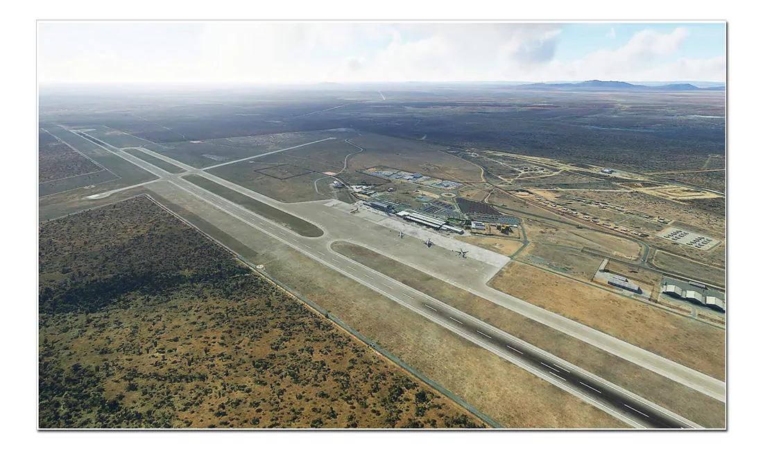
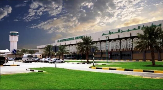
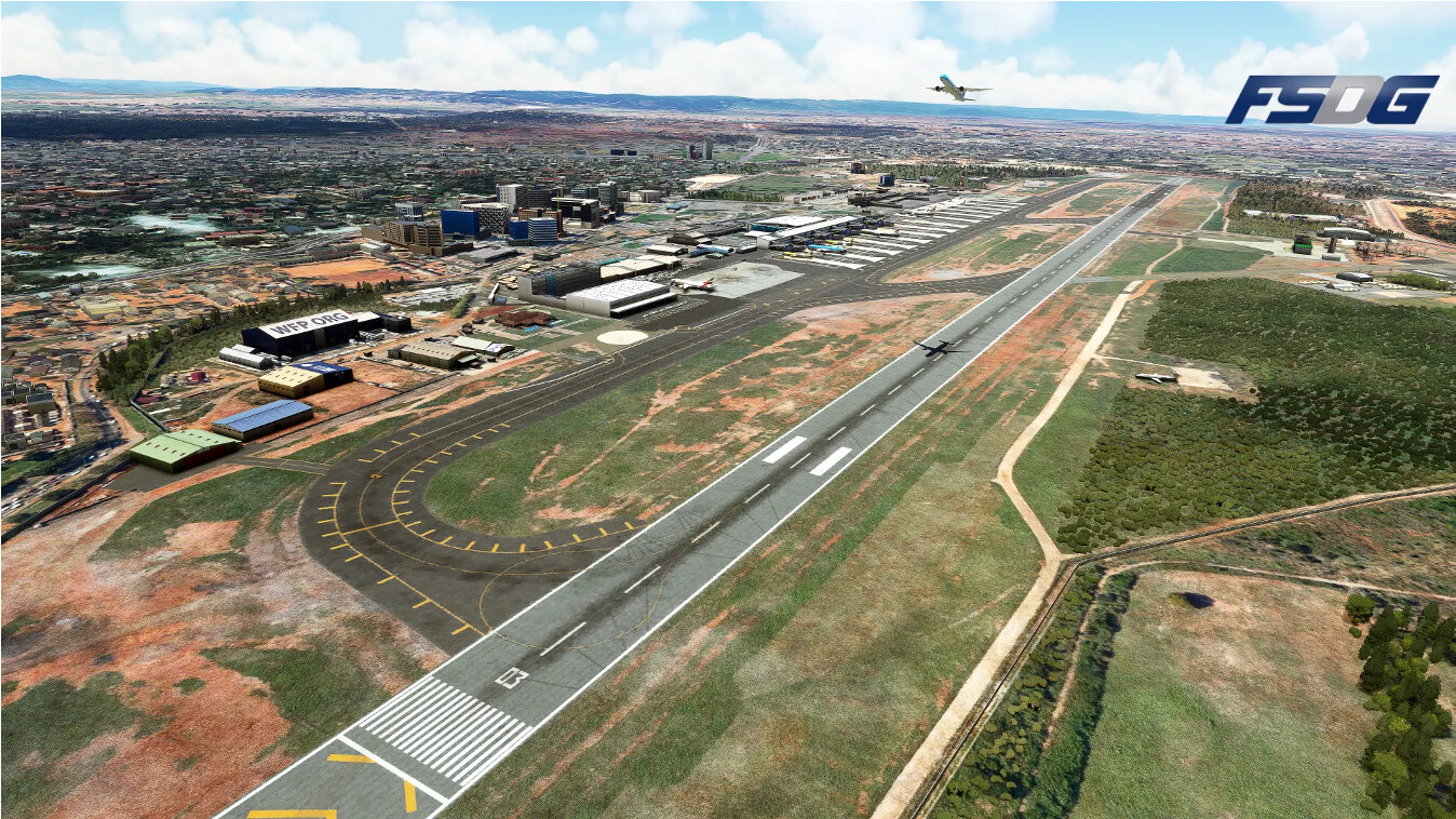
Al Ain International Airport (IATA AAN) is a strategic powerhouse in the Middle East. Geographically positioned as a perfect bridge between Asia and Europe, it serves as a critical stopover for long-haul heavy cargo and passenger operations. Taxi ways available so no need for a backtrack!
Location: Northwest Al Ain (The Garden City), Abu Dhabi Emirate Runway(s): 01 / 19 —> 13,123 ft × 148 ft / 4,000 m × 45 m ILS + RNAV Available
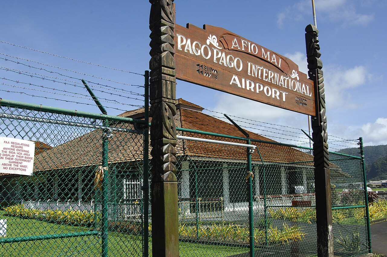
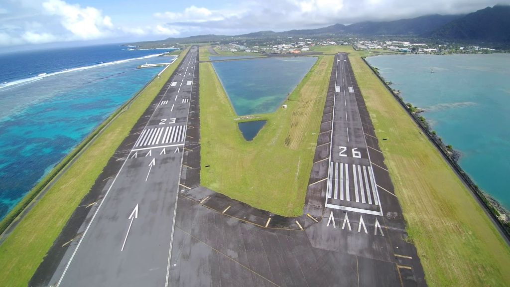
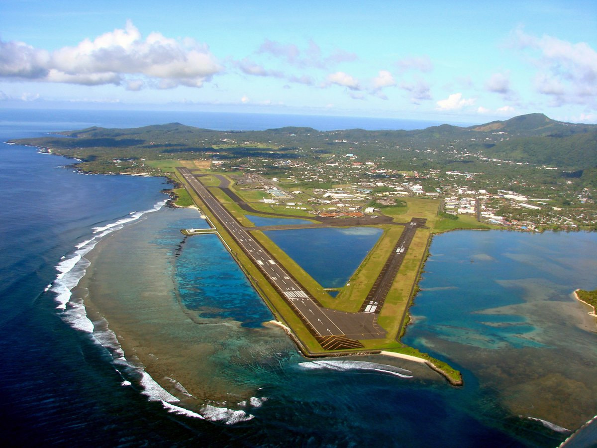
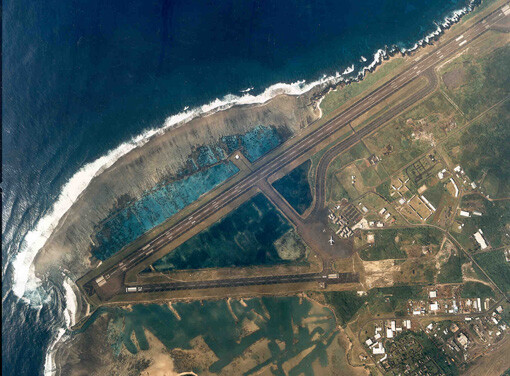
Pago Pago International Airport (NSTU) is the primary airport serving American Samoa, located on Tutuila Island in the South Pacific. The airport sits very close to sea level and is surrounded by mountainous terrain, making approaches visually impressive and sometimes challenging.
The main runway (05/23) is long enough to accommodate medium to large commercial aircraft, while the secondary runway (08/26) is typically used by smaller aircraft. Due to its island location, weather and wind conditions can change rapidly, adding realism and difficulty for flight simulation operations.
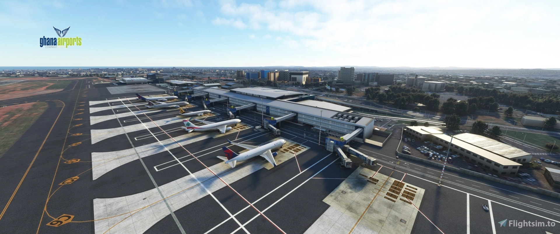
Introduction:
Accra Kotoka International Airport is Ghana’s primary international gateway and one of the most important aviation hubs in West Africa. Located just northeast of central Accra, the airport supports a mix of intercontinental widebody operations, regional African routes, and domestic traffic. With a single long runway capable of handling heavy aircraft such as the A330, A350, and Boeing 777, DGAA is well suited for long-haul simulation flights to Europe, the Middle East, and North America.
Introduction:
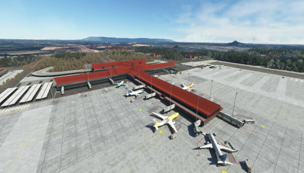
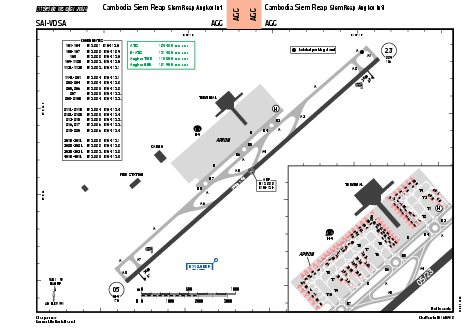
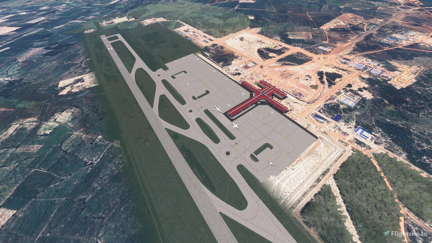
Siem Reap–Angkor International Airport (IATA: SAI, ICAO: VDSA) is an international airport in Soutr Nikom District, Siem Reap province serving the city of Siem Reap, Cambodia. It is 18 km (11 mi) northeast of Damdek, 40 km (25 mi) east of Angkor Wat and 50 km (31 mi) east of Siem Reap. It is the second largest airport in Cambodia after the Phnom Penh Techo International Airport. SAI covers an area of 700 hectares (1,730 acres) of land and has a 3,600 m runway. The airport can handle 65,800 flights and 7 million passengers annually, projected to increase to 112,700 flights and 12 million passengers annually from 2040.
Hakodate Airport (HKD) is considered Hokkaido’s second-largest airport by passenger traffic with a single 3,000 m runway oriented 12/30 capable of handling regional and international jet traffic. The airport’s manageable size makes it ideal for general aviation flights, short, medium and long haul airline operations, and flight simulation sessions involving weather challenges such as seasonal winds and snow.
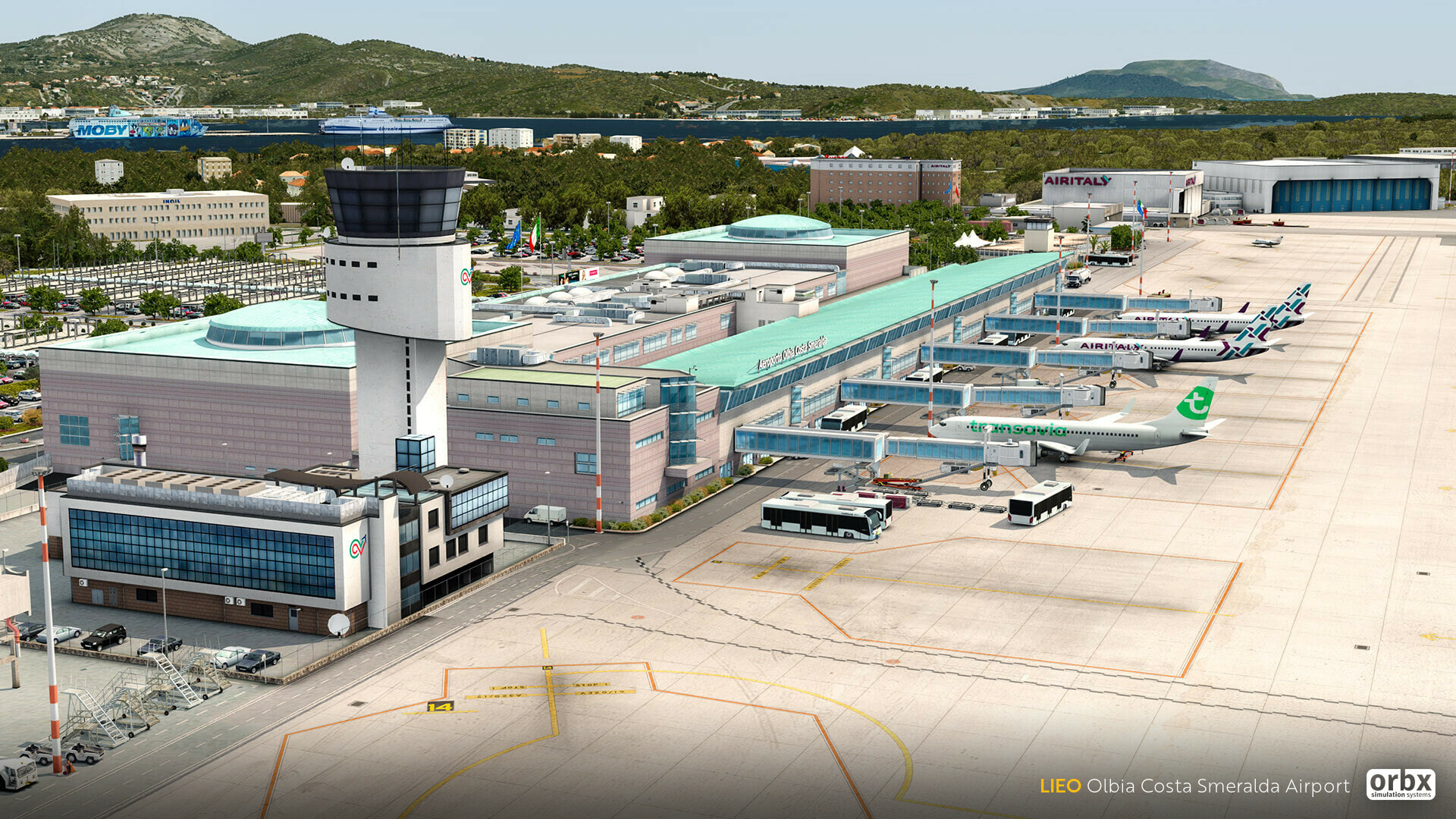
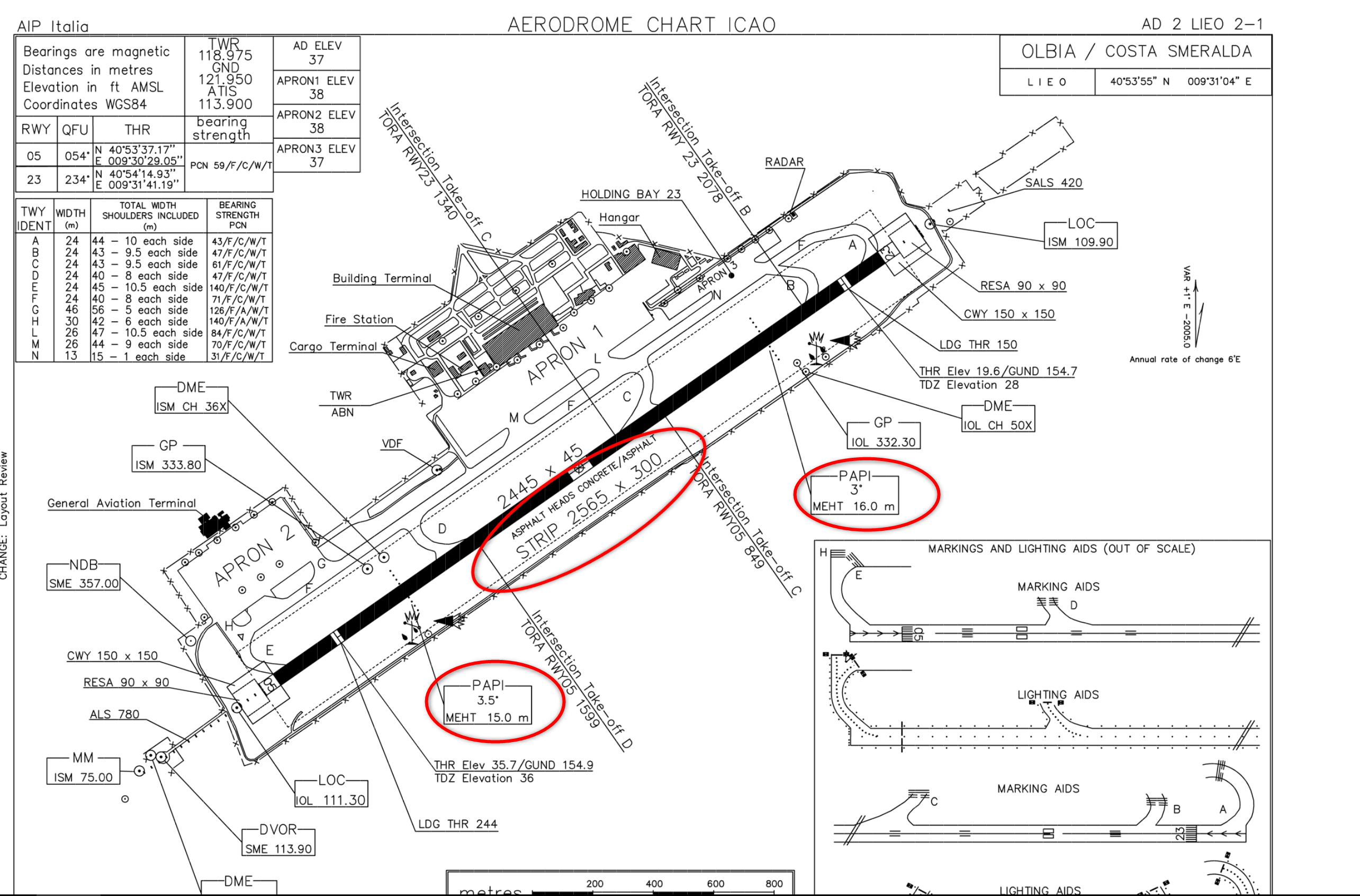
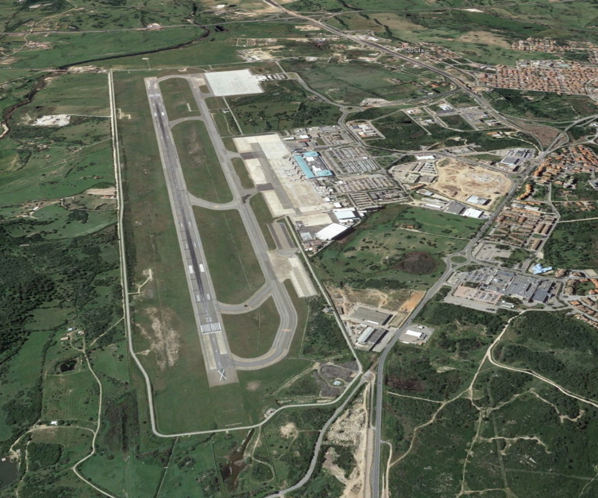
ICAO: LIEO
SimFly category: 4
Pilot payout: 60%
Location: ITALY SARDEGNA
Runway(s): 05/23 (2.745 m- 9.006ft)
Elevation: 37 ft / 11 m
Introduction:
Olbia-Costa Smeralda-Prince Karim Aga Khan IV Airport (Italian: Aeroporto di Olbia-Costa Smeralda) (IATA: OLB, ICAO: LIEO) is an airport in Olbia, Sardinia, Italy. It was the primary operating base for Italian airline Air Italy whose headquarters were located at the airport. It mostly handles seasonal holiday flights from destinations in Europe and is managed by Geasar S.p.A.