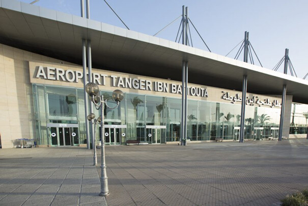
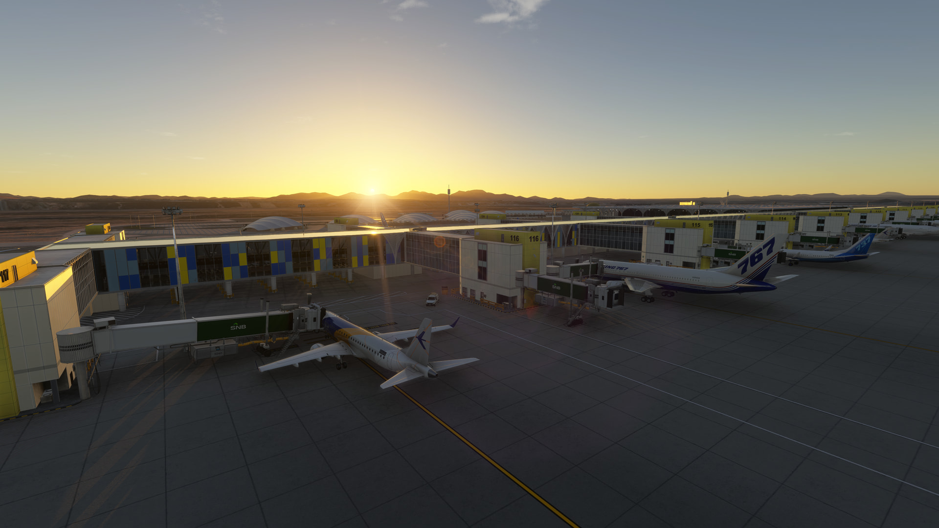
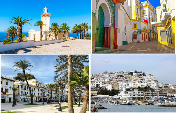
Airport Information Board

GMTT - Ibn Batouta

Tangier - Morocco

ICAO: GMTT
SimFly category: 4
Pilot payout: 60%
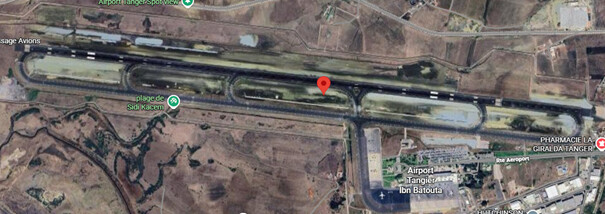
Location: Tangier – Morocco Google Maps

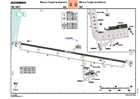
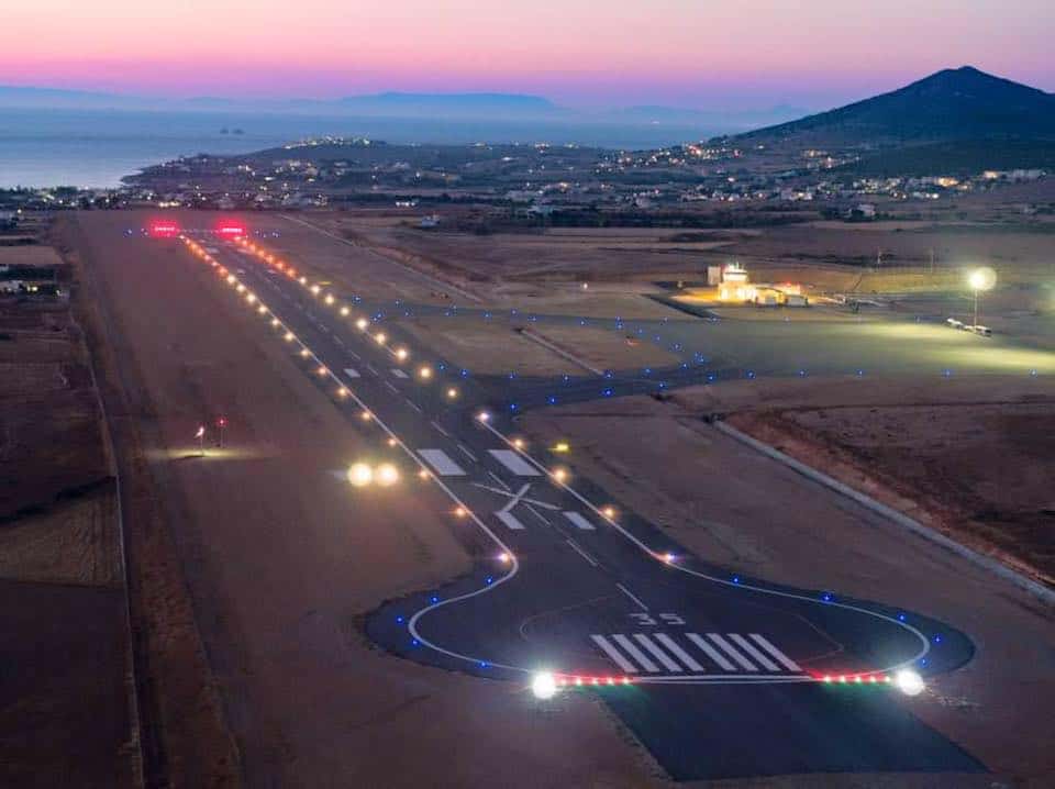
Runway(s): 10/28 (3 500m-11 483 ft)
Elevation: 19 m -62 ft

Freeware : MSFS2020/2024 Flightsim.to: Simpixel Tangier Enhancement Pack for Microsoft Flight Simulator | MSFS
FSXcenery – GMTT Tangier Ibn Battouta Airport v1.0.0 | Simmods - simmods
Payware : MSFS In-game Store (2options, from Redwing and Simpixel)
SimPixel Tangier (GMTT) for MSFS – iniBuilds Store
simMarket: GMTT TANGIER IBN BATTUTA AIRPORT MSFS

Introduction:
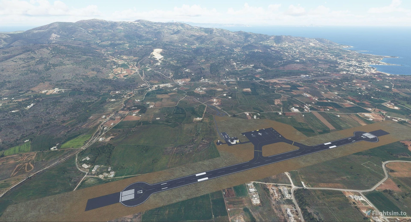
Tangier Ibn Battouta Airport (IATA: TNG, ICAO: GMTT) is an international airport serving Tangier, the capital city of the Tanger-Tetouan-Al Hoceima region in the North of Morocco. The airport is named after Ibn Battuta (1304–1368), a Moroccan traveller who was born in Tangier. The airport was formerly known as Tanger-Boukhalef AirportThe airport handled over 1,070,247 passengers in the year 2017.


1 Like

LGPA PAROS ISLAND
GREECE Cyclades Islands

ICAO: LGPA
SimFly category: 3
Pilot payout: 60%
Location: GREECE Cyclades Islands
Runway(s): 17/35 (1.400 m- 4.593ft)
Elevation: 125 ft / 38 m

Introduction:
Paros National Airport (IATA: PAS, ICAO: LGPA) is the airport serving the island of Paros, Greece, in the Cyclades islands region. The airport is located in the southwestern part of the island, about 10 kilometres (6.2 mi) from the port of Parikia. It replaced the Old Paros National Airport on 25 July 2016.

The old airport of Paros, which was situated a few kilometers to the south, was operational since 1982. Its 710-meter runway became insufficient as larger numbers of passengers required larger aircraft, so a new airport was built, opening in 2016, and taking over all operations of the old airport. Its wide, 1,400 meter runway supports larger aircraft.

1 Like

KIWA - Williams Gateway

Phoenix - Arizona - USA

ICAO: KIWA
SimFly category: 4
Pilot payout: 60%
Location: Phoenix - Arizona - USA Google Maps
Elevation: 1,384 ft / 422 m
Runways:
12C/30C 10,201ft / 3,109m
12L/30R 9,300ft / 2,835m
12R/30L 10,401ft / 3,170m

Freeware : ??
Payware : MSFS In-game Store
https://secure.simmarket.com/fsxcenery-kiwa-phoenix-mesa-gateway-msfs.phtml

Introduction:
Mesa Gateway Airport[a] (IATA: AZA, ICAO: KIWA, FAA LID: IWA) – also known as Phoenix–Mesa Airport – is an airport in southeastern Mesa, Arizona, located approximately 20 miles (17 nmi; 32 km) southeast of Phoenix, in Maricopa County. The airport, owned and operated by the Mesa Gateway Airport Authority, is a reliever airport for Phoenix Sky Harbor International Airport. It is a base for Allegiant Air.


2 Likes

OEMA – Prince Mohammad bin Abdulaziz International Airport, Madinah, Saudi Arabia

ICAO: OEMA
SimFly category: 4
Pilot payout: 60%
Location: Western Saudi Arabia, Al Madinah Region – Google Maps

Runway(s):
17/35, 14,222 ft x 197 ft / 4,335 m x 60 m
18/36, 10,007 ft x 148 ft / 3,050 m x 45 m
Elevation: 2,151 ft / 656 m

Flightsim.to: MSFS freeware OEMA – Madinah Airport by VForce
MSFS payware scenery: https://secure.simmarket.com/tuwaiq-designs-prince-mohammad-bin-abdulaziz-international-airport-msfs.phtml
XPlane gateway scenery: X-Plane Scenery Gateway – OEMA
SkyVector: SkyVector airport information and charts for OEMA
Other Resources: Prince Mohammad Bin Abdulaziz International Airport

Introduction:
Prince Mohammad bin Abdulaziz International Airport serves the holy city of Madinah and is one of Saudi Arabia’s most important airports, especially during the Hajj and Umrah pilgrimage seasons. The airport regularly handles high-density widebody operations from across the Middle East, Asia, Africa, and Europe, making it an excellent destination for long-haul and charter flights in flight simulation. With two long asphalt runways, multiple ILS-equipped approaches, and extensive apron space including royal and remote stands, OEMA offers realistic airline and heavy-jet operations. For simulation pilots, the combination of desert terrain, heat performance considerations, and complex arrival and departure procedures adds operational depth, while the proximity to Madinah’s landmarks makes it a culturally and aviation-significant destination.


Detailed Scenery Review with many more scenery images

3 Likes

KBHM - Birmingham-Shuttlesworth International Airport**, Alabama, United States**

ICAO: KBHM
SimFly category: 4
Pilot payout: 60%
Location: Alabama, United States – Google Maps

Runway(s):
06/24, 12,007 ft x 150 ft / 3,660 m x 46 m
18/36, 7,099 ft x 150 ft / 2,164 m x 46 m
Elevation: 650 ft / 198 m

Flightsim.to payware scenery: KBHM – Birmingham-Shuttlesworth International Airport
MSFS payware scenery: KBHM Birmingham-Shuttlesworth International Airport - ORBX
XPlane gateway scenery: X-Plane Scenery Gateway – KBHM
SkyVector: SkyVector airport information and charts for KBHM
Other Resources: Birmingham-Shuttlesworth International Airport (BHM)

Introduction:
The capital of the state of Alabama, Birmingham welcomes you with one of the most impressive airports in the Southern United States. KBHM is classified as a Category 4 airport in the U.S. and makes an impact from the very first glance: one of the largest runways in the region, an incredible 12,007 feet (3,660 m), certified to receive the giant Airbus A380 on IVAO.

2 Likes

RJSS - Sendai Airport, Miyagi Prefecture, Japan

ICAO: RJSS
SimFly category: 4
Pilot payout: 60%
Location: Pacific coast of northeastern Honshu, south of Sendai city – Google Maps

Runway(s):
09/27, 9843 ft x 148 ft / 3000 m x 45 m
12/30, 3937 ft x 148 ft / 1200 m x 45 m
Elevation: 15 ft / 5 m

Flightsim.to: (RJSS) Sendai Intl Airport for Microsoft Flight Simulator | MSFS
Flightsim.to: Enhanced lights and airport details
Flightsim.to: GSX Profile for RJSS

XPlane gateway scenery: X-Plane Scenery Gateway
SkyVector: RJSS - Sendai Airport | SkyVector
AirNav: AirNav airport details and data for RJSS

Other:
If the name sounds familiar - Sendai airport was famously flooded by the 2011 Tōhoku Japan earthquake and tsunami. Shocking footage of the terrible event is available here:

image

Introduction:
Sendai Airport is the primary international gateway to Japan’s Tōhoku region and one of the most recognizable coastal airports in the country. Positioned just a few meters above sea level, it features long, jet-capable Runway 09/27 with full ILS support, making it well suited for both regional turboprops and narrowbody airliners. The airport is well known among aviation enthusiasts for its role in the 2011 Tōhoku earthquake and tsunami, after which it was completely restored and modernized. In flight simulation, RJSS offers a mix of overwater approaches, detailed Japanese airspace procedures, and realistic regional airline operations, making it a popular destination for IFR practice and domestic Japanese routes.


2 Likes

Click for interactive SimFly Airports By Owner map - Updated 2026-03-07-07:31 GMT
image

Pro Tip - You can select multiple folders then show or hide them using the selected features panel in the top-right.

Guidelines:

  • Only one airport per post.
  • This thread is for airport information posts only. Please use personal messages or direct chat for general commentary.
  • Airports that do not follow the format below will not be added to the Airport Information Board world map.

CORRECT FORMAT EXAMPLE

PAJN - Juneau International Airport, Alaska, USA

ICAO: PAJN
Category: 4
Pilot payout: 60%
Any illustrations, graphics, icons or additional information you would like to add should be included AFTER the required information above.

Use the blue “Reply” button below to add your airport.